Dioïla Cercle
Dioïla | |
|---|---|
UTC+0 (GMT ) |
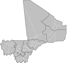
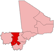
Dioïla Cercle is an administrative subdivision of the
Dioïla. It lies at the southeast corner of the region, and prior to 1977, it was combined with what is now Kati Cercle and the District of Bamako
in the "Bamako Cercle", with the capital city as its seat.
The Dioïla Cercle is divided into 23 communes:[3][4]
- Banco
(containing the town of Dioïla) - Benkadi
- Binko
- Dégnékoro
- Diébé
- Diédougou
- Diouman
- Dolendougou
- Guégnéka
- Jékafo
- Kaladougou
- Kémékafo
- Kéréla
- Kilidougou
- Massigui
- N'Dlondougou
- N'Garadougou
- N'Golobougou
- Nangola
- Niantjila
- Ténindougou
- Wacoro
- Zan Coulibaly
Dioïla Cercle is home to primarily
Maraka, Fula, and Bozo fishing communities. The Cercle falls largely south of the dryer Sahel land, in the wetter Sudan. It is also home to the headwaters of the Bani River
.
References
- ^ Synthèsis des Plans de Securité Alimentaire des Communes du Cercle Dioïla 2008-2012 (PDF) (in French), Commissariat à la Sécurité Alimentaire, République du Mali, USAID-Mali, 2008, archived from the original (PDF) on 2011-07-26, retrieved 2011-02-01.
- ^ Resultats Provisoires RGPH 2009 (Région de Koulikoro) (PDF) (in French), République de Mali: Institut National de la Statistique, archived from the original (PDF) on 2011-07-22.
- ^ Loi N°99-035/ du 10 Aout 1999 Portant Création des Collectivités Territoriales de Cercles et de Régions (PDF) (in French), Ministère de l'Administration Territoriales et des Collectivités Locales, République du Mali, 1999, archived from the original (PDF) on 2012-03-09.
- ^ Communes de la Région de Koulikoro (PDF) (in French), Ministère de l’administration territoriale et des collectivités locales, République du Mali, archived from the original (PDF) on 2012-03-09. Names of communes are in upper-case without accents.


