Division of Australian Capital Territory
| Australian Capital Territory Division | |
|---|---|
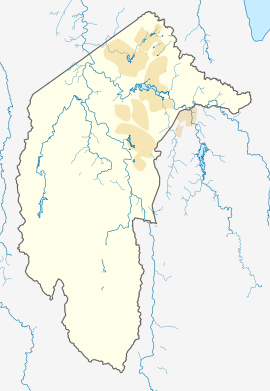
 Map of the Australian Capital Territory | |
| Created | 1949 |
| Abolished | 1974 |
| MP |
|
| Party |
|
| Namesake | Australian Capital Territory |
| Demographic | Metropolitan and rural |
The Division of Australian Capital Territory was an
Australian electoral division in the Territory of the same name. The division was created in 1949 and included the whole of the city of Canberra
and surrounding rural areas.
Prior to 1949, the Australian Capital Territory (ACT) had no representation in the Australian Parliament. The ACT's first member was elected at the 1949 federal election. However, until 1966 he could only vote on matters relating to the ACT and did not count for the purposes of forming government. In 1966, full voting rights were granted.[1] For most of its history it was a fairly safe seat for the Australian Labor Party.
In 1974, the division was divided into two new divisions, Canberra and Fraser. The last member for the united division, Kep Enderby, transferred to Canberra.
Members
| Image | Member | Party | Term | Notes | |
|---|---|---|---|---|---|

|
Lewis Nott (1886–1951) |
Independent
|
10 December 1949 – 28 April 1951 |
Previously held the Division of Herbert. Lost seat | |

|
Jim Fraser (1908–1970) |
Labor | 28 April 1951 – 1 April 1970 |
Died in office | |

|
Kep Enderby (1926–2015) |
30 May 1970 – 18 May 1974 |
Served as minister under Whitlam. Transferred to the Division of Canberra after Australian Capital Territory was abolished in 1974
|
Election results
References
- ^ "Places - Australian Capital Territory". Documenting a democracy. National Archives of Australia. 2010. Archived from the original on 12 October 2009. Retrieved 15 September 2010.
