
Edmondson, Arkansas
Edmondson, Arkansas | ||
|---|---|---|
FIPS code 05-20830 | | |
| GNIS feature ID | 2406425[2] | |
Edmondson is a town in
Geography
Edmondson is located in south-central Crittenden County and is 4 miles (6 km) south of Interstate 40, which then leads 6 miles (10 km) east to West Memphis and 14 miles (23 km) east to downtown Memphis, Tennessee.
According to the United States Census Bureau, Edmondson has a total area of 3.2 square miles (8.4 km2), all land.[3]
Demographics
| Census | Pop. | Note | %± |
|---|---|---|---|
| 1910 | 342 | — | |
| 1920 | 325 | −5.0% | |
| 1930 | 302 | −7.1% | |
| 1940 | 308 | 2.0% | |
| 1950 | 283 | −8.1% | |
| 1960 | 288 | 1.8% | |
| 1970 | 412 | 43.1% | |
| 1980 | 344 | −16.5% | |
| 1990 | 286 | −16.9% | |
| 2000 | 513 | 79.4% | |
| 2010 | 427 | −16.8% | |
| 2020 | 243 | −43.1% | |
| U.S. Decennial Census[4] | |||
2020 Census
| Race / Ethnicity (NH = Non-Hispanic) | Pop 2000[5] | Pop 2010[6] | Pop 2020[7] | % 2000 | % 2010 | % 2020 |
|---|---|---|---|---|---|---|
White alone (NH)
|
230 | 118 | 66 | 16.65% | 27.63% | 27.16% |
Black or African American alone (NH)
|
1,116 | 281 | 169 | 80.81% | 65.81% | 69.55% |
Alaska Native alone (NH)
|
3 | 0 | 0 | 0.22% | 0.00% | 0.00% |
| Asian alone (NH) | 1 | 2 | 0 | 0.07% | 0.47% | 0.00% |
| Pacific Islander alone (NH) | 0 | 0 | 0 | 0.00% | 0.00% | 0.00% |
| Some Other Race alone (NH) | 1 | 0 | 0 | 0.07% | 0.00% | 0.00% |
| Mixed Race or Multi-Racial (NH) | 19 | 12 | 7 | 1.38% | 2.81% | 2.88% |
| Hispanic or Latino (any race) | 11 | 14 | 1 | 0.80% | 3.28% | 0.41% |
| Total | 1,381 | 427 | 243 | 100.00% | 100.00% | 100.00% |
As of the
There were 174 households, out of which 42.5% had children under the age of 18 living with them, 47.7% were married couples living together, 26.4% had a female householder with no husband present, and 19.0% were non-families. 15.5% of all households were made up of individuals, and 5.7% had someone living alone who was 65 years of age or older. The average household size was 2.95 and the average family size was 3.29.
In the town, the population was spread out, with 35.9% under the age of 18, 9.0% from 18 to 24, 25.7% from 25 to 44, 18.5% from 45 to 64, and 10.9% who were 65 years of age or older. The median age was 29 years. For every 100 females, there were 98.1 males. For every 100 females age 18 and over, there were 90.2 males.
The median income for a household in the town was $28,056, and the median income for a family was $30,000. Males had a median income of $29,000 versus $17,917 for females. The
Education
Edmondson is served by the West Memphis School District,[9] which operates Academies of West Memphis (formerly West Memphis High School).
References
- ^ "2020 U.S. Gazetteer Files". United States Census Bureau. Retrieved October 29, 2021.
- ^ a b U.S. Geological Survey Geographic Names Information System: Edmondson, Arkansas
- ^ a b "Geographic Identifiers: 2010 Demographic Profile Data (G001): Edmondson town, Arkansas". U.S. Census Bureau, American Factfinder. Retrieved June 20, 2014.
- ^ "Census of Population and Housing". Census.gov. Retrieved June 4, 2015.
- ^ "P004 Hispanic or Latino, and Not Hispanic or Latino by Race – 2000: DEC Summary File 1 – Edmondson town, Arkansas". United States Census Bureau.
- ^ "P2 Hispanic or Latino, and Not Hispanic or Latino by Race – 2010: DEC Redistricting Data (PL 94-171) – Edmondson town, Arkansas". United States Census Bureau.
- ^ "P2 Hispanic or Latino, and Not Hispanic or Latino by Race – 2020: DEC Redistricting Data (PL 94-171) – Edmondson town, Arkansas". United States Census Bureau.
- ^ "U.S. Census website". United States Census Bureau. Retrieved January 31, 2008.
- U.S. Census Bureau. Retrieved May 14, 2018. Note: Since the production of the map, the Turrell School District merged into the Marion school district
External links
Municipalities and communities of Crittenden County, Arkansas, United States | ||
|---|---|---|
| Cities | 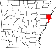 | |
| Towns | ||
| Unincorporated communities | ||
| ||