
Egegik, Alaska
Egegik, Alaska
Igyagiiq, Igya'iq, Igyagiq | ||
|---|---|---|
FIPS code 02-21150 | | |
| GNIS feature ID | 1401686 | |
Egegik (
Geography

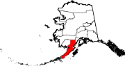
Egegik is at 58°13′9″N 157°21′29″W / 58.21917°N 157.35806°W (58.219292, -157.357989)[6] on the eastern shores of both Bristol Bay and, more locally, of Egegik Bay. The village is on a high bluff along the southern shore of the Egegik River at the upper extent of Egegik Bay.
.jpeg)
According to the United States Census Bureau, the city has an area of 134.0 square miles (347 km2), of which, 32.8 square miles (85 km2) is land and 101.2 square miles (262 km2) (75.54%) is water.
Demographics
| Census | Pop. | Note | %± |
|---|---|---|---|
| 1880 | 120 | — | |
| 1890 | 60 | −50.0% | |
| 1900 | 203 | 238.3% | |
| 1920 | 83 | — | |
| 1930 | 86 | 3.6% | |
| 1940 | 125 | 45.3% | |
| 1950 | 119 | −4.8% | |
| 1960 | 150 | 26.1% | |
| 1970 | 148 | −1.3% | |
| 1980 | 75 | −49.3% | |
| 1990 | 122 | 62.7% | |
| 2000 | 116 | −4.9% | |
| 2010 | 109 | −6.0% | |
| 2020 | 39 | −64.2% | |
| U.S. Decennial Census[7] | |||
.jpeg)
Egegik first appeared on the 1880 U.S. Census as the unincorporated Inuit village of Igagik. It appeared again under that name in 1890 and 1900. It returned again in 1920 as Egegik.[8]
As of the census
.jpeg)
There were 44 households, out of which 29.5% had children under the age of 18 living with them, 36.4% were married couples living together, 2.3% had a female householder with no husband present, and 47.7% were non-families. 36.4% of all households were made up of individuals, and none had someone living alone who was 65 years of age or older. The average household size was 2.64 and the average family size was 3.74.
In the city, the age distribution of the population shows 32.8% under the age of 18, 7.8% from 18 to 24, 35.3% from 25 to 44, 20.7% from 45 to 64, and 3.4% who were 65 years of age or older. The median age was 35 years. For every 100 females, there were 146.8 males. For every 100 females age 18 and over, there were 116.7 males.
The median income for a household in the city was $46,000, and the median income for a family was $59,583. Males had a median income of $39,375 versus $40,000 for females. The
References
- Alaska Department of Community and Regional Affairs. January 1996. p. 51.
- ^ "Senator Lyman Hoffman". Alaska Senate Majority. Alaskasenate.org. Archived from the original on April 8, 2020. Retrieved November 16, 2019.
- ^ "2020 U.S. Gazetteer Files". United States Census Bureau. Retrieved October 29, 2021.
- ^ "SUK972L1982d-smaller" (PDF). www.uafanlc.alaska.edu. Retrieved June 26, 2023.
- ^ "2020 Census Data - Cities and Census Designated Places" (Web). State of Alaska, Department of Labor and Workforce Development. Retrieved December 5, 2021.
- ^ "US Gazetteer files: 2010, 2000, and 1990". United States Census Bureau. February 12, 2011. Retrieved April 23, 2011.
- ^ "Census of Population and Housing". Census.gov. Retrieved June 4, 2015.
- ^ "Geological Survey Professional Paper". 1949.
- ^ "U.S. Census website". United States Census Bureau. Retrieved January 31, 2008.
 | ||||
| CDPs | ||||
| Ghost town | ||||
| ||||