
Eldred Township, Schuylkill County, Pennsylvania
Eldred Township, Schuylkill County, Pennsylvania | |
|---|---|
UTC-4 (EDT) | |
| FIPS code | 42-107-22912 |
Eldred Township is a township in Schuylkill County, Pennsylvania, United States. Settled in 1805 and incorporated in 1849 from part of Upper Mahantongo Township, it is named for Judge Nathaniel Eldred. The population was 709 at the 2020 census.[2]
Geography
According to the United States Census Bureau, the township has a total area of 22.2 square miles (57 km2), all land. Part of the Weiser State Forest is located in the township.
Demographics
| Census | Pop. | Note | %± |
|---|---|---|---|
| 2010 | 758 | — | |
| 2020 | 709 | −6.5% | |
| 2021 (est.) | 709 | [2] | 0.0% |
| U.S. Decennial Census[3] | |||
As of the
There were 271 households, out of which 29.2% had children under the age of 18 living with them, 67.5% were married couples living together, 5.2% had a female householder with no husband present, and 23.2% were non-families. 21.0% of all households were made up of individuals, and 10.3% had someone living alone who was 65 years of age or older. The average household size was 2.65 and the average family size was 3.09.
In the township the population was spread out, with 20.7% under the age of 18, 8.9% from 18 to 24, 27.3% from 25 to 44, 24.8% from 45 to 64, and 18.4% who were 65 years of age or older. The median age was 41 years. For every 100 females, there were 109.6 males. For every 100 females age 18 and over, there were 111.9 males.
The median income for a household in the township was $34,667, and the median income for a family was $37,083. Males had a median income of $27,632 versus $20,962 for females. The
Gallery
-
 Eldred Township Office.
 -
 St. James Lutheran Church in Pitman.
 -
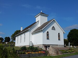
 St. Paul's Church.
 -
 Hepler's Church of God.


References
- ^ "2016 U.S. Gazetteer Files". United States Census Bureau. Retrieved August 14, 2017.
- ^ a b c d Bureau, US Census. "City and Town Population Totals: 2020—2021". Census.gov. US Census Bureau. Retrieved August 1, 2022.
- ^ "Census of Population and Housing". Census.gov. Retrieved June 4, 2016.
- ^ "U.S. Census website". United States Census Bureau. Retrieved January 31, 2008.

40°45′01″N 76°24′59″W / 40.75028°N 76.41639°W
| International | |
|---|---|
| National | |