
Elliston, Montana
Elliston, Montana | ||
|---|---|---|
FIPS code 30-23950 | | |
| GNIS feature ID | 0783161[2] | |
Elliston is a
The town is most likely named after
Geography
Elliston is located at 46°34′02″N 112°26′42″W / 46.567089°N 112.444965°W (46.567089, -112.444965).[4]
According to the United States Census Bureau, the CDP has a total area of 8.8 square miles (23 km2), all land.
Climate
This
| Climate data for Elliston, Montana, 1991–2020 normals, 1920-2020 extremes: 5080ft (1548m) | |||||||||||||
|---|---|---|---|---|---|---|---|---|---|---|---|---|---|
| Month | Jan | Feb | Mar | Apr | May | Jun | Jul | Aug | Sep | Oct | Nov | Dec | Year |
| Record high °F (°C) | 57 (14) |
58 (14) |
73 (23) |
81 (27) |
89 (32) |
96 (36) |
100 (38) |
100 (38) |
94 (34) |
82 (28) |
70 (21) |
56 (13) |
100 (38) |
| Mean maximum °F (°C) | 49.5 (9.7) |
51.2 (10.7) |
60.5 (15.8) |
71.6 (22.0) |
79.9 (26.6) |
87.7 (30.9) |
94.0 (34.4) |
92.3 (33.5) |
88.0 (31.1) |
74.5 (23.6) |
60.4 (15.8) |
48.1 (8.9) |
92.9 (33.8) |
| Mean daily maximum °F (°C) | 32.6 (0.3) |
33.1 (0.6) |
43.2 (6.2) |
50.8 (10.4) |
60.4 (15.8) |
68.6 (20.3) |
80.9 (27.2) |
80.4 (26.9) |
68.9 (20.5) |
53.3 (11.8) |
39.3 (4.1) |
31.2 (−0.4) |
53.6 (12.0) |
| Daily mean °F (°C) | 21.7 (−5.7) |
22.5 (−5.3) |
31.2 (−0.4) |
38.3 (3.5) |
47.7 (8.7) |
54.8 (12.7) |
63.5 (17.5) |
62.3 (16.8) |
52.7 (11.5) |
40.1 (4.5) |
28.3 (−2.1) |
20.8 (−6.2) |
40.3 (4.6) |
| Mean daily minimum °F (°C) | 10.7 (−11.8) |
11.9 (−11.2) |
19.2 (−7.1) |
25.8 (−3.4) |
35.0 (1.7) |
41.0 (5.0) |
46.0 (7.8) |
44.1 (6.7) |
36.4 (2.4) |
27.0 (−2.8) |
17.3 (−8.2) |
10.4 (−12.0) |
27.1 (−2.7) |
| Mean minimum °F (°C) | −15.8 (−26.6) |
−14.6 (−25.9) |
−2.7 (−19.3) |
9.5 (−12.5) |
21.6 (−5.8) |
30.2 (−1.0) |
36.6 (2.6) |
34.0 (1.1) |
25.5 (−3.6) |
7.7 (−13.5) |
−3.4 (−19.7) |
−14.0 (−25.6) |
−23.9 (−31.1) |
| Record low °F (°C) | −41 (−41) |
−41 (−41) |
−30 (−34) |
−3 (−19) |
9 (−13) |
24 (−4) |
24 (−4) |
24 (−4) |
5 (−15) |
−12 (−24) |
−40 (−40) |
−43 (−42) |
−43 (−42) |
| Average precipitation inches (mm) | 1.12 (28) |
1.04 (26) |
1.37 (35) |
1.77 (45) |
2.49 (63) |
2.79 (71) |
1.45 (37) |
1.39 (35) |
1.40 (36) |
1.76 (45) |
1.48 (38) |
1.05 (27) |
19.11 (486) |
| Average snowfall inches (cm) | 11.2 (28) |
13.7 (35) |
10.5 (27) |
8.0 (20) |
2.1 (5.3) |
0.2 (0.51) |
0.0 (0.0) |
0.2 (0.51) |
0.8 (2.0) |
5.2 (13) |
8.3 (21) |
15.4 (39) |
75.6 (191.32) |
| Source 1: NOAA[6] | |||||||||||||
| Source 2: XMACIS2 (2004-2020 snowfall, records & monthly max/mins)[7] | |||||||||||||
Demographics
| Census | Pop. | Note | %± |
|---|---|---|---|
| 2000 | 225 | — | |
| 2010 | 219 | −2.7% | |
| 2020 | 227 | 3.7% | |
| U.S. Decennial Census[8] | |||
As of the
There were 89 households, out of which 41.6% had children under the age of 18 living with them, 57.3% were married couples living together, 11.2% had a female householder with no husband present, and 27.0% were non-families. 22.5% of all households were made up of individuals, and 12.4% had someone living alone who was 65 years of age or older. The average household size was 2.53 and the average family size was 2.94.
In the CDP, the population was spread out, with 32.0% under the age of 18, 2.7% from 18 to 24, 28.0% from 25 to 44, 23.6% from 45 to 64, and 13.8% who were 65 years of age or older. The median age was 36 years. For every 100 females, there were 94.0 males. For every 100 females age 18 and over, there were 96.2 males.
The median income for a household in the CDP was $31,964, and the median income for a family was $38,333. Males had a median income of $33,750 versus $21,875 for females. The
References
- ^ "ArcGIS REST Services Directory". United States Census Bureau. Retrieved September 5, 2022.
- ^ a b U.S. Geological Survey Geographic Names Information System: Elliston, Montana
- ^ a b "Elliston". Montana Place Names Companion. Montana Historical Society. Retrieved April 2, 2021.
- ^ "US Gazetteer files: 2010, 2000, and 1990". United States Census Bureau. February 12, 2011. Retrieved April 23, 2011.
- ^ Climate Summary for Elliston, Montana
- ^ "Elliston, Montana 1991-2020 Monthly Normals". Retrieved November 23, 2023.
- ^ "xmACIS". National Oceanic and Atmospheric Administration. Retrieved November 23, 2023.
- ^ "Census of Population and Housing". Census.gov. Retrieved June 4, 2016.
- ^ "U.S. Census website". United States Census Bureau. Retrieved January 31, 2008.
Municipalities and communities of Powell County, Montana, United States | ||
|---|---|---|
| City | 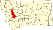 | |
| CDPs | ||
| Other community | ||
| ||