
File:0001jfVicente Enriquez Josefa Ycasiano Ancestral House Matungao Bulakan Bulacan Roadsfvf 15.jpg

Size of this preview: 800 × 600 pixels. Other resolutions: 320 × 240 pixels | 640 × 480 pixels | 1,024 × 768 pixels | 1,280 × 960 pixels | 2,560 × 1,920 pixels | 4,608 × 3,456 pixels.
Original file (4,608 × 3,456 pixels, file size: 6.16 MB, MIME type: image/jpeg)
| This is a file from the Wikimedia Commons. Information from its description page there is shown below. Commons is a freely licensed media file repository. You can help. |
Summary
| Description |
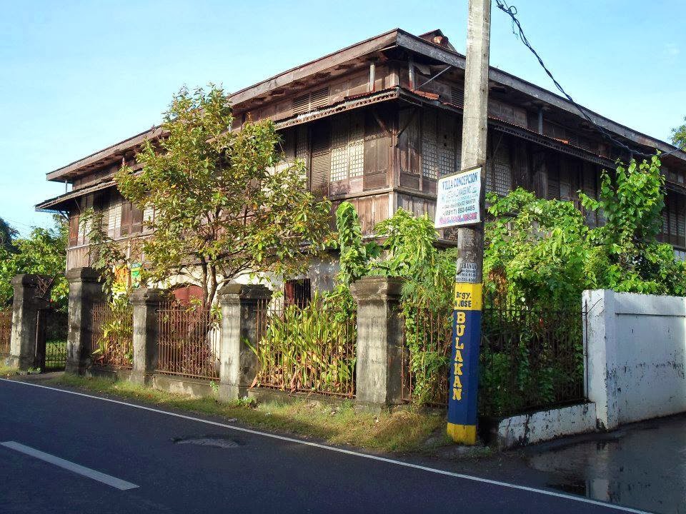
English: Vicente Enriquez & Josefa Ycasiano Ancestral House in Matungao, Bulakan, Bulacan Enriquez Vicente Enriquez - Josefa Ycasiano house The Vicente Enriquez - Josefa Ycasiano house inherited by Jacinto "Titong" Enriquez who married Milagros "Mila" Santiago of Malolos Spanish-era ancestral house, house of local food historian Mila Enriquez 14°47′51″N 120°52′40″E
List of Cultural Properties of the Philippines in Bulakan, Bulacan from the Tabang, Guiguinto - San Francisco, Bulacan, Bulacan Municipal Road into the Balubad, Maysantol, San Jose and Bagumbayan, San Francisco, Bulakan, Bulacan Municipal Road to Matungao Provincial Road, Bulacan, Bulacan into Camino Real Provincial Road into the Pitpitan, San Nicolas, Maysantol and San Jose, Bulacan, Bulacan Provincial Barangay Matungao 14°48'17"N 120°53'13"E Matungao Bridge 14°48'12"N 120°52'48"E Santo Cristo Chapel 14°48'5"N 120°52'47"E San Jose 14°47'38"N 120°52'34"E Bulacan, Bulacan Bulacan province, (accessed from MacArthur Highway or Manila North Road interconnecting with Cagayan Valley Road, Baliuag-Pulilan-Guiguinto, Bulacan, Pan-Philippine Highway, also known as the Maharlika "Nobility/freeman" Highway) (Note: Judge Florentino Floro, the owner, to repeat, Donor Florentino Floro of all these photos hereby donate gratuitously, freely and unconditionally all these photos to and for Wikimedia Commons, exclusively, for public use of the public domain, and again without any condition whatsoever). |
| Date | |
| Source | Own work |
| Author | Judgefloro |
| Camera location | | View this and other nearby images on: OpenStreetMap |
|---|
Matungao 14°48'17"N 120°53'13"E
Licensing
I, the copyright holder of this work, hereby publish it under the following license:
| This file is made available under the Creative Commons CC0 1.0 Universal Public Domain Dedication. | |
| The person who associated a work with this deed has dedicated the work to the public domain by waiving all of their rights to the work worldwide under copyright law, including all related and neighboring rights, to the extent allowed by law. You can copy, modify, distribute and perform the work, even for commercial purposes, all without asking permission.
|
File history
Click on a date/time to view the file as it appeared at that time.
| Date/Time | Thumbnail | Dimensions | User | Comment | |
|---|---|---|---|---|---|
| current | 11:39, 17 May 2017 | | 4,608 × 3,456 (6.16 MB) | Judgefloro | User created page with UploadWizard |
File usage
The following pages on the English Wikipedia use this file (pages on other projects are not listed):