
Galtür
This article has multiple issues. Please help improve it or discuss these issues on the talk page. (Learn how and when to remove these template messages)
|
Galtür | ||
|---|---|---|
 | ||
|
Postal code 6563 | ||
| Area code | 05443 | |
| Vehicle registration | LA | |
| Website | www.galtuer.gv.at | |
Galtür is a village and
History
Galtür was settled by the Engadiners from the south, the Walsers and Vorarlbergers from the west, and Tyroleans from the east. Today the cultivation work of the Engadiners is remembered in the name Galtür, meaning Cultura. During the Thirty Years' War, Galtür was badly damaged. The church and many houses were burned down. The first roads leading through the Paznaun were built in the 19th century. During that period, Galtür consisted of a church, an inn, and eight houses, and was considered very poor. After the first hotel was built, the Jamtalhütte was soon constructed. With the advent of tourism, Galtür and the valley became prosperous.
On February 23, 1999, an
Ski Resort
Galtür is a popular tourist destination in winter. There are 40 km (25 mi) of perfectly prepared pistes and a varied selection of slopes to explore. Galtür is a family-friendly ski area. Most ski slopes range from easy to medium difficulty. In addition, ski pros find challenging runs and many deep snow slopes without any tracks. There are 10 mountain railways and lifts, including the eight-seater Alpkogel gondola. Wednesday evenings, night skiing is possible on a floodlit piste.
Galtür's ski resort is called Silvapark and is located 2 kilometres outside the main village in the small village of Wirl. Ski buses run along the main road through Galtür between the ski area and other destinations in the valley, including Ischgl, Kappl, and See. There are stops in Galtür at the Hotel Alpenrose, Dorfplatz, and Alpinarium, as well as one stop next to the Birkhahnbahn chair lift in Wirl. In Wirl, skiers and snowboarders can take either the Birkahahnbahn chair lift or the Alpkogelbahn Gondola up onto the mountain.
Silvapark offers 40 km of groomed pistes served by 3 chair lifts, 1 gondola and 5 smaller tow lifts. Many of the runs are marked Blue and Red, making the resort accessible to families and beginners. In addition to these, the resort also offers a number of more difficult Red and Black runs, which means, coupled with the off piste possibilities, the resort caters for more advanced skiers and snowboarders too. Off piste opportunities through trees and between runs, particularly surrounding the Breitspitzbahn chair lift, are available, even for less experienced skiers. This area is much quieter and has better on-piste conditions.
There are several mountain huts and restaurants on the mountain which offer traditional Austrian cuisine and a friendly atmosphere. Most offer indoor and outdoor dining areas as well as smoking and non-smoking areas respectively. At the bottom of the Alpkogelbahn Gondola, there are a number of hotels which have ski in ski out facilities. These hotels offer accommodation and facilities for those who would rather not take a ski bus.
Climate
| Climate data for Galtür: 1587m (1991−2020 normals) | |||||||||||||
|---|---|---|---|---|---|---|---|---|---|---|---|---|---|
| Month | Jan | Feb | Mar | Apr | May | Jun | Jul | Aug | Sep | Oct | Nov | Dec | Year |
| Record high °C (°F) | 19.1 (66.4) |
22.0 (71.6) |
23.2 (73.8) |
29.0 (84.2) |
32.9 (91.2) |
35.0 (95.0) |
36.9 (98.4) |
37.8 (100.0) |
32.4 (90.3) |
26.9 (80.4) |
23.2 (73.8) |
16.1 (61.0) |
37.8 (100.0) |
| Mean daily maximum °C (°F) | −0.5 (31.1) |
0.7 (33.3) |
4.1 (39.4) |
8.3 (46.9) |
12.9 (55.2) |
17.1 (62.8) |
18.4 (65.1) |
18.0 (64.4) |
14.6 (58.3) |
10.3 (50.5) |
3.9 (39.0) |
0.1 (32.2) |
9.0 (48.2) |
| Daily mean °C (°F) | −4.7 (23.5) |
−4.1 (24.6) |
−0.5 (31.1) |
3.3 (37.9) |
7.9 (46.2) |
11.4 (52.5) |
13.3 (55.9) |
13.1 (55.6) |
9.3 (48.7) |
5.6 (42.1) |
−0.1 (31.8) |
−3.9 (25.0) |
4.2 (39.6) |
| Mean daily minimum °C (°F) | −8.6 (16.5) |
−9.4 (15.1) |
−5.4 (22.3) |
−1.7 (28.9) |
2.4 (36.3) |
5.7 (42.3) |
7.3 (45.1) |
7.3 (45.1) |
4.0 (39.2) |
0.5 (32.9) |
−4.1 (24.6) |
−7.5 (18.5) |
−0.8 (30.6) |
| Record low °C (°F) | −22.7 (−8.9) |
−20.0 (−4.0) |
−19.2 (−2.6) |
−7.5 (18.5) |
−0.8 (30.6) |
2.4 (36.3) |
5.6 (42.1) |
3.7 (38.7) |
−0.1 (31.8) |
−9.2 (15.4) |
−12.0 (10.4) |
−19.9 (−3.8) |
−22.7 (−8.9) |
| Average precipitation mm (inches) | 50.0 (1.97) |
39.9 (1.57) |
49.8 (1.96) |
39.9 (1.57) |
75.2 (2.96) |
113.6 (4.47) |
128.4 (5.06) |
141.7 (5.58) |
84.5 (3.33) |
62.4 (2.46) |
53.0 (2.09) |
52.3 (2.06) |
890.7 (35.08) |
| Average snowfall cm (inches) | 87.9 (34.6) |
92.7 (36.5) |
80.2 (31.6) |
57.1 (22.5) |
13.0 (5.1) |
3.2 (1.3) |
0.3 (0.1) |
0.7 (0.3) |
7.2 (2.8) |
28.3 (11.1) |
69.4 (27.3) |
91.3 (35.9) |
531.3 (209.1) |
| Source: Central Institute for Meteorology and Geodynamics[3]
| |||||||||||||
| Climate data for Galtür (1971–2000) | |||||||||||||
|---|---|---|---|---|---|---|---|---|---|---|---|---|---|
| Month | Jan | Feb | Mar | Apr | May | Jun | Jul | Aug | Sep | Oct | Nov | Dec | Year |
| Record high °C (°F) | 10.0 (50.0) |
11.4 (52.5) |
17.0 (62.6) |
17.8 (64.0) |
23.4 (74.1) |
25.6 (78.1) |
29.6 (85.3) |
29.4 (84.9) |
26.6 (79.9) |
21.2 (70.2) |
16.4 (61.5) |
12.1 (53.8) |
29.6 (85.3) |
| Mean daily maximum °C (°F) | −0.3 (31.5) |
0.6 (33.1) |
3.6 (38.5) |
6.3 (43.3) |
12.3 (54.1) |
15.2 (59.4) |
17.8 (64.0) |
17.6 (63.7) |
14.6 (58.3) |
10.5 (50.9) |
3.3 (37.9) |
0.3 (32.5) |
8.5 (47.3) |
| Daily mean °C (°F) | −5.5 (22.1) |
−5.3 (22.5) |
−2.1 (28.2) |
1.0 (33.8) |
6.4 (43.5) |
9.3 (48.7) |
11.7 (53.1) |
11.4 (52.5) |
7.9 (46.2) |
3.9 (39.0) |
−1.9 (28.6) |
−4.5 (23.9) |
2.7 (36.9) |
| Mean daily minimum °C (°F) | −9.5 (14.9) |
−9.6 (14.7) |
−6.2 (20.8) |
−3.1 (26.4) |
1.4 (34.5) |
4.1 (39.4) |
6.3 (43.3) |
6.4 (43.5) |
3.3 (37.9) |
−0.3 (31.5) |
−5.7 (21.7) |
−8.3 (17.1) |
−1.8 (28.8) |
| Record low °C (°F) | −29.4 (−20.9) |
−25.0 (−13.0) |
−27.5 (−17.5) |
−16.4 (2.5) |
−13.3 (8.1) |
−5.0 (23.0) |
−2.6 (27.3) |
−3.6 (25.5) |
−6.8 (19.8) |
−16.0 (3.2) |
−22.5 (−8.5) |
−26.5 (−15.7) |
−29.4 (−20.9) |
| Average precipitation mm (inches) | 78.9 (3.11) |
62.9 (2.48) |
74.4 (2.93) |
65.4 (2.57) |
87.6 (3.45) |
134.9 (5.31) |
156.2 (6.15) |
142.7 (5.62) |
100.0 (3.94) |
67.1 (2.64) |
80.2 (3.16) |
77.2 (3.04) |
1,127.5 (44.39) |
| Average snowfall cm (inches) | 89.5 (35.2) |
103.4 (40.7) |
96.8 (38.1) |
74.5 (29.3) |
15.2 (6.0) |
4.5 (1.8) |
0.6 (0.2) |
1.1 (0.4) |
6.0 (2.4) |
18.1 (7.1) |
68.8 (27.1) |
90.8 (35.7) |
569.3 (224.1) |
| Average precipitation days (≥ 1.0 mm) | 10.3 | 8.5 | 11.2 | 11.8 | 12.6 | 14.8 | 15.3 | 14.1 | 10.8 | 9.1 | 10.2 | 10.7 | 139.4 |
| Average relative humidity (%) (at 14:00)
|
63.1 | 60.0 | 56.4 | 56.3 | 52.2 | 55.3 | 53.9 | 55.4 | 53.4 | 54.1 | 64.1 | 66.3 | 57.5 |
| Source: Central Institute for Meteorology and Geodynamics[4]
| |||||||||||||
Gallery
-
 Wallfahrtskirche Mariä Geburtstag Catholic parish church
 -
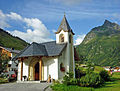 Chapel at Wirl, Galtür
 -
 Alpinarium
 -
 View of Galtür from the avalanche path
 -
 Memorial for the 31 avalanche victims who died in Galtür in February 1999
 -
 Galtür and the Silvretta Strasse road
 -
 Avalanche protection in Tschaffein


References
- ^ "Dauersiedlungsraum der Gemeinden Politischen Bezirke und Bundesländer - Gebietsstand 1.1.2018". Statistics Austria. Retrieved 10 March 2019.
- ^ "Einwohnerzahl 1.1.2018 nach Gemeinden mit Status, Gebietsstand 1.1.2018". Statistics Austria. Retrieved 9 March 2019.
- ^ "Klimamittelwerte 1991-2020" (in German). Central Institute for Meteorology and Geodynamics. Retrieved 31 August 2023.
- ^ "Klimadaten von Österreich 1971–2000 – Tirol-Galtür" (in German). Central Institute for Meteorology and Geodynamics. Archived from the original on 12 October 2019. Retrieved 20 October 2019.
External links
- Galtür
- Historie of Galtür (german)
- Alpinarium Galtür
- Tourismoffice Paznaun Galtür
- Silvretta Galtür Cablecars
| International | |
|---|---|
| National | |