
Grannis, Arkansas
Grannis, Arkansas | ||
|---|---|---|
FIPS code 05-27970 | | |
| GNIS feature ID | 2403726[2] | |
Grannis is a city in
Near Grannis is the Boggs Springs Youth Encampment of the
Geography
Grannis is located at 34°14′20″N 94°19′42″W / 34.23889°N 94.32833°W (34.238884, -94.328404).[3]
According to the United States Census Bureau, the city has a total area of 8.6 square miles (22 km2), all land.
Demographics
2020 census
| Race | Number | Percentage |
|---|---|---|
White (non-Hispanic)
|
292 | 58.87% |
Native American
|
8 | 1.61% |
Other/Mixed
|
28 | 5.65% |
Latino
|
168 | 33.87% |
As of the 2020 United States census, there were 496 people, 259 households, and 184 families residing in the city.
2000 census
| Census | Pop. | Note | %± |
|---|---|---|---|
| 1940 | 225 | — | |
| 1950 | 193 | −14.2% | |
| 1960 | 185 | −4.1% | |
| 1970 | 177 | −4.3% | |
| 1980 | 349 | 97.2% | |
| 1990 | 507 | 45.3% | |
| 2000 | 575 | 13.4% | |
| 2010 | 554 | −3.7% | |
| 2020 | 496 | −10.5% | |
| U.S. Decennial Census[5] | |||
As of the
There were 210 households, out of which 37.6% had children under the age of 18 living with them, 68.1% were married couples living together, 7.6% had a female householder with no husband present, and 21.9% were non-families. 18.1% of all households were made up of individuals, and 4.8% had someone living alone who was 65 years of age or older. The average household size was 2.74 and the average family size was 3.10.
In the city, the population was spread out, with 26.6% under the age of 18, 11.5% from 18 to 24, 26.1% from 25 to 44, 24.2% from 45 to 64, and 11.7% who were 65 years of age or older. The median age was 32 years. For every 100 females, there were 101.0 males. For every 100 females age 18 and over, there were 103.9 males.
The median income for a household in the city was $29,083, and the median income for a family was $30,893. Males had a median income of $22,500 versus $17,000 for females. The
Education
It is in the Cossatot River School District.
Grannis, in the 1950s, was assigned to Gillham(?) schools in Sevier County.[7] At a later point it was in the Wickes School District,[8] which consolidated into the Cossatot River district on July 1, 2010.[9]
References
- ^ "2020 U.S. Gazetteer Files". United States Census Bureau. Retrieved October 29, 2021.
- ^ a b c U.S. Geological Survey Geographic Names Information System: Grannis, Arkansas
- ^ "US Gazetteer files: 2010, 2000, and 1990". United States Census Bureau. February 12, 2011. Retrieved April 23, 2011.
- ^ "Explore Census Data". data.census.gov. Retrieved December 31, 2021.
- ^ "Census of Population and Housing". Census.gov. Retrieved June 4, 2015.
- ^ "U.S. Census website". United States Census Bureau. Retrieved January 31, 2008.
- ^ "Arkansas Department of Education school district maps, 1952-1954 Polk County, 1952-1954". Arkansas Digital Archives. Arkansas State Archives. (Download) - which notes that Grannis was assigned to Sevier schools, and
"Arkansas Department of Education school district maps, 1952-1954 Sevier County, 1952-1954". Arkansas Digital Archives. Arkansas State Archives. (Download) - U.S. Census Bureau. Retrieved March 7, 2021.
- ^ "ConsolidationAnnex_from_1983.xls." Arkansas Department of Education. Retrieved on May 23, 2018.
Municipalities and communities of Polk County, Arkansas, United States | ||
|---|---|---|
| Cities | 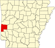 | |
| Towns | ||
| CDPs | ||
| Other unincorporated communities | ||
| ||