Grayrigg Forest
| Grayrigg Forest | |
|---|---|
Clem | |
| Coordinates | 54°23′31″N 2°37′14″W / 54.39208°N 2.6206°W |
| Geography | |
| OS grid | SD598998 |
| Topo map | OS Landranger 97 |
Grayrigg Forest is a hill in
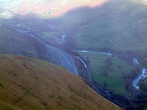
valley.From near the summit, there are impressive views down into the gorge of the Lune valley, where road, West Coast Main Line railway, M6 motorway and the River Lune crowd between the outliers of the Lake District and the Howgill Fells.
It is one of three summits, along with
Lake District National Park boundary was extended in 2019, including them for the first time.[4]

References
- ISBN 978-1-78362-813-1. Retrieved 8 February 2021.
- ISBN 9780319232088.
- ^ "Grayrigg Forest". www.themountainguide.co.uk. Retrieved 15 March 2016.
- ^ a b "Grayrigg Forest". www.hill-bagging.co.uk. Retrieved 8 February 2021.
- ^ "Lake District fells hiking guides". Cicerone Press. Retrieved 8 February 2021.


