
Heimdal, North Dakota
Heimdal, North Dakota | ||
|---|---|---|
FIPS code 38-37020 | | |
| GNIS feature ID | 2584347[2] | |
Heimdal (
History
On May 6, 2015, a train carrying oil
Geography
According to the United States Census Bureau, the CDP has a total area of 0.47 square miles (1.22 km2), all land.
Demographics
| Census | Pop. | Note | %± |
|---|---|---|---|
| 2020 | 16 | — | |
| U.S. Decennial Census[5] | |||
2010 census
As of the census
There were 13 households, of which 23.1% had children under the age of 18 living with them, 38.5% were married couples living together, 7.7% had a female householder with no husband present, and 53.8% were non-families. 46.2% of all households were made up of individuals, and 38.5% had someone living alone who was 65 years of age or older. The average household size was 2.08 and the average family size was 3.17.
The median age in the CDP was 43.8 years. 29.6% of residents were under the age of 18; 3.7% were between the ages of 18 and 24; 22.2% were from 25 to 44; 11.1% were from 45 to 64; and 33.3% were 65 years of age or older. The gender makeup of the CDP was 33.3% male and 66.7% female.
References
- ^ "ArcGIS REST Services Directory". United States Census Bureau. Retrieved September 20, 2022.
- ^ a b U.S. Geological Survey Geographic Names Information System: Heimdal, North Dakota
- ^ "U.S. Census Bureau: Heimdal CDP, North Dakota". www.census.gov. United States Census Bureau. Retrieved January 28, 2022.
- ^ "Heimdal, North Dakota, Evacuated After Fiery Oil Train Crash". NBC News. May 6, 2015. Retrieved June 30, 2017.
- ^ "Census of Population and Housing". Census.gov. Retrieved June 4, 2016.
- ^ "U.S. Census website". United States Census Bureau. Retrieved May 14, 2011.
External links
Municipalities and communities of Wells County, North Dakota, United States | ||
|---|---|---|
| Cities | 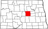 | |
| Townships |
| |
| CDP | ||
| Other communities | ||
| Indian reservation | ||
| Footnotes | ‡This populated place also has portions in an adjacent county or counties | |
| ||
| International | |
|---|---|
| National | |