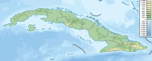
Hicacos Peninsula
Appearance
Location of Hicacos Peninsula in Cuba
The Hicacos Peninsula (
Varadero
is located on the peninsula. The name comes from a species of cactus.
Geography
It is located between the Bay of Cárdenas and the Nicholas Channel of the Atlantic Ocean, and its extremity (Punta Hicacos) constitutes the northernmost point of the island of Cuba. It has a length of 18 kilometres (11 mi)[1] and its width varies between 0.5 km (0.31 mi) and 2.5 km (1.6 mi).
The
Sabana-Camaguey Archipelago
.
The Kawama navigation channel was opened between the Bay of Cardenas and the northern shore, to allow faster transit of ships from the port of
Via Blanca
highway, and it provides access to the resorts and marina located on the northern end.
Tourism

The white sand beaches that line the northern shore lead to the development of the resort town of Varadero close to the mainland, while the farther end is lined with
ecological preserve established in 1974 on the north-eastern tip. It contains the 250 m (820 ft) long Cave of Ambrosio, Mangón Lake (home to 31 species of birds and 24 species of reptiles) and the ruins of the La Calavera (The Skull) Salt Works, one of the first salt works to be constructed by the Spanish in the New World.[2]
See also
References
- ^ The Columbia Gazetteer of North America (2000). "Hicacos Peninsula". Archived from the original on 2005-03-14. Retrieved 2007-10-14.
- ^ Cuba Travel. "Varadero, Cuba". Retrieved 2007-10-14.
23°11′52″N 81°09′05″W / 23.19778°N 81.15139°W

