
Kümüx
Kümüx
كۈمۈش بازىرى 库米什镇 Kumishi, Kʻu-mi-shih | ||
|---|---|---|
Postal code 838104 | ||
Kümüx
Name
'Kümüx' (كۈمۈش) means 'silver' in Uyghur. Silver is mined in the area.[3][7]
Kümüx has also been written in Chinese characters as Kumushi (庫穆什 / 库穆什 and 庫木什 / 库木什).[3]
History
In 1984, Kümüx Town was established.[1]
In December 2010, Zeng Lingquan (曾令权), who ran an adoption agency for the physically and mentally disabled with no operation license in Sichuan, was arrested. Zeng reportedly sent the mentally ill to work in a factory run by Li Xinglin (李兴林) where they were enslaved and worked year round (instead of seasonally as with other local factories) in unsafe conditions at the Jia'ersi Green Construction Material Chemical Factory (佳尔思绿色建材化工厂) in Kümüx.[8][9][10]
Geography
The nearby Kuruktag[4][11] (Kuluketage; 库鲁克塔格) mountains (at around 41°30′N 090°00′E / 41.500°N 90.000°E) are a source of gold, silver, copper, lead, zinc, iron and other metals as well as asbestos, marble, mengfeitu (蒙肥土), limestone, table salt, mirabilite, gypsum and quartz.[3]
Administrative divisions
Kümüx includes one
Residential community:
- Kümüx (Kumishi; 库米什社区)
Villages:
- Qirghiz tam (Ke'erkezitiemi; قىرغىز تام كەنتى[13] / 柯尔克孜铁米村)
- Yëngi bostan (Yingbositan; يېڭى بوستان كەنتى / 英博斯坦村) 42°11′08″N 088°22′42″E / 42.18556°N 88.37833°E[14]
Economy
Kümüx is an important stop on the road from Ürümqi to Kashgar. There are restaurants, a transport and shipping station, a regional weather station, hotel, post office, gas station, etc. There is little arable land in the surrounding area and spring water is used in irrigation.[3]
Demographics
| Year | Pop. | ±% p.a. |
|---|---|---|
| 2000 | 1,119 | — |
| 2010 | 1,389 | +2.19% |
| [2] | ||
As of 2003[update], more than 600 persons lived in Kümüx, mostly Uyghur.[3] As of 1997[update], 88.1% of the population of Kümüx were Uyghur.[1]
During the
Transportation
- China National Highway 314[3]
- S24 Shanku Expressway
Historical maps
Historical English-language maps including Kümüx:
-
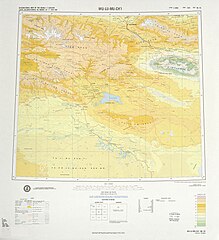 Map including Kümüx (labeled as Kʻu-mi-shih) and surrounding region from theDMA, 1975)
 -
 From the Operational Navigation Chart; map including Kumüx (DMA, 1982)
 -
 Map including Kümüx (DMA, 1990)


References
- ^ a b c d e 1997年托克逊县行政区划 [1997 Toksun County Administrative Divisions]. XZQH.org. 11 January 2011. Retrieved 29 June 2020.
库米什镇 1984年设镇。位于县城以南,距县城100千米。 面积约812平方千米,人口0.05万,其中维吾尔族约占88.1%。辖库米什居委会和柯尔克孜铁米、英博斯坦2村委会。
- ^ a b 托克逊县历史沿革 [Toksun County Historical Development]. XZQH.org (in Simplified Chinese). 10 February 2015. Retrieved 29 June 2020.
- ^ ISBN 7-228-08004-1.
- ^ a b Complete Atlas Of The World (3 ed.). Penguin Random House. 2016. p. 238 – via Internet Archive.
Kümüx{...}Kuruktag
- ^ Kümüx (Approved - N) at GEOnet Names Server, United States National Geospatial-Intelligence Agency
- ^ كۈمۈش (Variant Non-Roman Script - VS) at GEOnet Names Server, United States National Geospatial-Intelligence Agency
- ISBN 978-7-80744-012-3.
- ^ "Asylum owner detained for selling mentally ill". China Daily. 14 December 2010. Retrieved 23 June 2020.
- ^ 智障包身工遭奴役:黑工厂老板逃逸 新疆警方跨省抓捕. China Daily (in Simplified Chinese). 14 December 2010. Retrieved 30 June 2020.
目前,托克逊县库米什佳尔思绿色建材化工厂已被查封,
- ^ "Officials punished over abuse of mentally ill workers in northwest China's Xinjiang".
- ^ Kuruktag (Approved - N) at GEOnet Names Server, United States National Geospatial-Intelligence Agency
- National Bureau of Statistics of the People's Republic of China. 2019. Retrieved 29 June 2020.
统计用区划代码 城乡分类代码 名称 650422101001 121 库米什社区 650422101200 220 柯尔克孜铁米村委会 650422101201 220 英博斯坦村委会
- ^ Mehrigul Nasir مىھرىگۈل ناسىر (22 October 2019). ئالتۇن رەڭ كەچ كۈز، گۈزەل توغراق. Tianshannet (in Uyghur). Retrieved 30 June 2020.
10- ئاينىڭ 16- كۈنى، توقسۇن ناھىيەسىنىڭ كۈمۈش بازىرى قىرغىز تام كەنتىنىڭ بەش كىلومېتىر جەنۇبىدىكى تاغ ئېتىكىگە جايلاشقان ئالتۇن رەڭ توغراقلىق خۇددى بىر پارچە ماي بوياق رەسىمگە ئوخشايدۇ.
- ^ Yingbositan (Approved - N) at GEOnet Names Server, United States National Geospatial-Intelligence Agency
This Xinjiang location article is a stub. You can help Wikipedia by expanding it. |