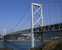
Kanmon Bridge


The Kanmon Bridge (関門橋, Kanmonkyō) (
Kyūshū side is Kitakyushu, whose former city and present ward, Moji
(門司), gave the strait its mon.
The Kanmon Bridge was opened to vehicles on November 14, 1973 and connected to the
50 largest suspension bridges
in the world with a central length of 1,068 metres (3,504 feet).
See also
External links
33°57′43″N 130°57′30″E / 33.96194°N 130.95833°E
