Kennet Avenue
This article needs additional citations for verification. (October 2010) |
| UNESCO World Heritage Site | |
|---|---|
 Kennet Avenue in 2014 | |
| Location | Wiltshire, United Kingdom |
| Part of | Avebury Section of Stonehenge, Avebury and Associated Sites |
| Criteria | Cultural: (i), (ii), (iii) |
| Reference | 373bis-002 |
| Inscription | 1986 (10th Session) |
| Extensions | 2008 |
| Coordinates | 51°25′23″N 1°50′53″W / 51.423°N 1.848°W |
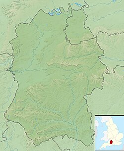
Kennet Avenue or West Kennet Avenue is a
prehistoric site in the English county of Wiltshire. It was an avenue of two parallel lines of stones 25m wide and 2.5 km in length, which ran between the Neolithic sites of Avebury and The Sanctuary
.
Excavations by
Beaker burials beneath some of them. Many stones have fallen or are missing, however. A second avenue, called Beckhampton Avenue, led west from Avebury towards Beckhampton Long Barrow
.
Maud Cunnington righted some of the stones during her work there in the early 20th century. Keiller restored the northern third of the avenue in 1934–1935.[1]
The avenue is within the Avebury section of the
National Trust, and a scheduled monument in English Heritage guardianship.[2] It is managed by the National Trust on behalf of English Heritage, and the two organisations share the cost of managing and maintaining the property.[3]
Images
-
'Male' and 'Female' stones in the Avenue
-
A megalith showing repairs
References
- OCLC 1201298091.
- ^ Historic England. "West Kennet Avenue and an earthwork bank east of West Kennett Farm (1015547)". National Heritage List for England. Retrieved 6 December 2020.
- ^ "West Kennet Avenue, Avebury". English Heritage. Retrieved 6 December 2020.
External links
![]() Media related to West Kennet Avenue at Wikimedia Commons
Media related to West Kennet Avenue at Wikimedia Commons


