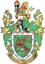
Kingswood Borough
| Kingswood | |
|---|---|
 | |
| Area | |
| • 1974 | 11,831 acres (47.88 km2)[1] |
| Population | |
| • 1973[2] | 78,210 |
| • 1992[3] | 91,200 |
| History | |
| • Created | 1 April 1974 |
| • Abolished | 31 March 1996 |
| • Succeeded by | South Gloucestershire |
| Status | Borough |
| Government | |
| • HQ | Kingswood |
| • Motto | Vigilando Custodimus (We are the watchful custodians) |
 | |

Kingswood was, from 1974 to 1996, a
County of Avon, England
.
The district was formed by the
Rural District from the administrative county of Gloucestershire. On 20 May 1987 the district was granted borough status.[citation needed
]
Following a review by the Local Government Commission for England, both the County of Avon and Borough of Kingswood were abolished on 1 April 1996. Kingswood was merged with the neighbouring Northavon District to form the unitary authority of South Gloucestershire.[4]
See also
References
- ISBN 978-0-11-750847-7.
- ^ Registrar General's annual estimated figure mid 1973
- ^ OPCS Key Population and Vital Statistics 1992
- ^ "The Avon (Structural Change) Order 1995". Office of Public Sector Information. 1995. Archived from the original on 30 January 2008. Retrieved 12 January 2009.
