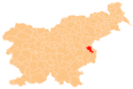
Klake, Kozje
Klake | |
|---|---|
Styria | |
| Statistical region | Savinja |
| Municipality | Kozje |
| Area | |
| • Total | 1.15 km2 (0.44 sq mi) |
| Elevation | 428.1 m (1,404.5 ft) |
| Population (2002) | |
| • Total | 179 |
| [1] | |
Klake (pronounced Styria region. The municipality is included in the Savinja Statistical Region.[2]
Name
The name Klake is derived from the Slovene common noun tlaka through dissimilation (tl- > kl-). The term tlaka originally referred to voluntary collective labor, and later to corvée under feudalism. The name refers to a place where collective labor was performed. Because places with this name generally do not lie near old Roman roads, the suggestion that the name is derived from tlak 'pavement' is unlikely.[3]
References
- ^ Statistical Office of the Republic of Slovenia
- ^ Kozje municipal site
- ^ Snoj, Marko (2009). Etimološki slovar slovenskih zemljepisnih imen. Ljubljana: Modrijan. p. 429.

