
Knob Lick, Missouri
Knob Lick, Missouri | ||
|---|---|---|
FIPS code 29-39170 | | |
| GNIS feature ID | 2806425[2] | |
Knob Lick is an
Missouri Route DD, just east of U.S. Route 67, approximately eight miles south of Farmington
.
Knob Lick has a
The community takes its name from nearby Knob Lick Mountain. In theconservation area which includes a granite glade, picnic facilities, and a closed fire lookout tower.[7]
Demographics
| Census | Pop. | Note | %± |
|---|---|---|---|
| 2020 | 147 | — | |
| U.S. Decennial Census[8] | |||
Notable people
- Tom Bayless (born 1947), American football player
References
- ^ "ArcGIS REST Services Directory". United States Census Bureau. Retrieved September 5, 2022.
- ^ a b c U.S. Geological Survey Geographic Names Information System: Knob Lick, Missouri
- ^ "ZIP code search". US Postal Service. Retrieved December 29, 2009.
- ^ "Post Offices". Jim Forte Postal History. Retrieved November 27, 2016.
- ^ "St. Francois County Place Names, 1928–1945". The State Historical Society of Missouri. Archived from the original on June 24, 2016. Retrieved November 27, 2016.
- ^ Eaton, David Wolfe (1918). How Missouri Counties, Towns and Streams Were Named. The State Historical Society of Missouri. p. 358.
- ^ "Knob Lick Towersite". Missouri Department of Conservation. Retrieved February 22, 2020.
- ^ "Census of Population and Housing". Census.gov. Retrieved June 4, 2016.
External links
| Cities | 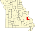 | |
|---|---|---|
| Townships | ||
| CDPs | ||
| Other communities | ||
| Ghost towns | ||
| Footnotes | ‡This populated place also has portions in an adjacent county or counties | |
| ||