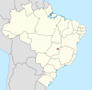
Lago Sul
Lago Sul | |
|---|---|
UTC−3 (BRT) | |
| Area code | +55 61 |
| Website | www |
Lago Sul (Portuguese pronunciation: Lake Paranoá, opposite of Brasília and Lago Norte. The Presidente Juscelino Kubitschek International Airport is located in the southwesternmost edge of the region.
Geography
Lago Sul is part of the Brazilian Highlands, with large amounts of cerrado vegetation.
Climate
Lago Sul has a
Koppen Classification
). | Climate data for Lago Sul (1991–2020, extremes 1961–present) | |||||||||||||
|---|---|---|---|---|---|---|---|---|---|---|---|---|---|
| Month | Jan | Feb | Mar | Apr | May | Jun | Jul | Aug | Sep | Oct | Nov | Dec | Year |
| Record high °C (°F) | 32.6 (90.7) |
32.0 (89.6) |
32.1 (89.8) |
31.6 (88.9) |
31.6 (88.9) |
31.6 (88.9) |
30.8 (87.4) |
33.0 (91.4) |
35.7 (96.3) |
36.4 (97.5) |
34.5 (94.1) |
33.7 (92.7) |
36.4 (97.5) |
| Mean daily maximum °C (°F) | 26.9 (80.4) |
27.2 (81.0) |
27.0 (80.6) |
26.8 (80.2) |
26.0 (78.8) |
25.3 (77.5) |
25.6 (78.1) |
27.4 (81.3) |
29.1 (84.4) |
29.0 (84.2) |
27.0 (80.6) |
26.8 (80.2) |
27.0 (80.6) |
| Daily mean °C (°F) | 21.9 (71.4) |
21.9 (71.4) |
21.8 (71.2) |
21.6 (70.9) |
20.3 (68.5) |
19.3 (66.7) |
19.3 (66.7) |
21.0 (69.8) |
22.8 (73.0) |
23.1 (73.6) |
21.7 (71.1) |
21.7 (71.1) |
21.4 (70.5) |
| Mean daily minimum °C (°F) | 18.3 (64.9) |
18.2 (64.8) |
18.2 (64.8) |
17.7 (63.9) |
15.6 (60.1) |
14.2 (57.6) |
13.9 (57.0) |
15.3 (59.5) |
17.6 (63.7) |
18.5 (65.3) |
18.1 (64.6) |
18.3 (64.9) |
17.0 (62.6) |
| Record low °C (°F) | 12.2 (54.0) |
11.0 (51.8) |
14.5 (58.1) |
10.7 (51.3) |
3.2 (37.8) |
3.3 (37.9) |
1.6 (34.9) |
5.0 (41.0) |
9.0 (48.2) |
10.2 (50.4) |
11.4 (52.5) |
11.4 (52.5) |
1.6 (34.9) |
| Average precipitation mm (inches) | 206.0 (8.11) |
179.5 (7.07) |
226.0 (8.90) |
145.2 (5.72) |
26.9 (1.06) |
3.3 (0.13) |
1.5 (0.06) |
16.3 (0.64) |
38.1 (1.50) |
141.8 (5.58) |
253.1 (9.96) |
241.1 (9.49) |
1,478.8 (58.22) |
| Average precipitation days (≥ 1.0 mm) | 16 | 14 | 15 | 9 | 3 | 1 | 0 | 2 | 4 | 10 | 17 | 18 | 109 |
| Average relative humidity (%)
|
74.7 | 74.2 | 76.1 | 72.2 | 65.4 | 58.8 | 51.0 | 43.5 | 46.4 | 58.8 | 74.5 | 76.0 | 64.3 |
| Mean monthly sunshine hours | 159.6 | 158.9 | 168.7 | 200.8 | 237.9 | 247.6 | 268.3 | 273.5 | 225.7 | 191.3 | 138.3 | 145.0 | 2,415.6 |
| Source 1: | |||||||||||||
| Source 2: Meteo Climat (record highs and lows)[8] | |||||||||||||
See also
- List of administrative regions of the Federal District
References
- ^ a b "Temperatura Máxima Mensal e Anual (°C)". Normais Climatológicas do Brasil 1991-2020 (in Portuguese). Instituto Nacional de Meteorologia. Archived from the original on 24 March 2022. Retrieved 24 March 2022.
- ^ a b "Temperatura Média Compensada Mensal e Anual (°C)". Normais Climatológicas do Brasil 1991-2020 (in Portuguese). Instituto Nacional de Meteorologia. Archived from the original on 24 March 2022. Retrieved 24 March 2022.
- ^ a b "Temperatura Mínima Mensal e Anual (°C)". Normais Climatológicas do Brasil 1991-2020 (in Portuguese). Instituto Nacional de Meteorologia. Archived from the original on 24 March 2022. Retrieved 24 March 2022.
- ^ a b "Precipitação Acumulada Mensal e Anual (mm)". Normais Climatológicas do Brasil 1991-2020 (in Portuguese). Instituto Nacional de Meteorologia. Archived from the original on 24 March 2022. Retrieved 24 March 2022.
- ^ a b "Número de dias no mês ou no ano com precipitação maior ou igual a (1 mm) (dias)". Normais Climatológicas do Brasil 1991-2020 (in Portuguese). Instituto Nacional de Meteorologia. Archived from the original on 24 March 2022. Retrieved 24 March 2022.
- ^ a b "Umidade Relativa do Ar Compensada Mensal e Anual (%)". Normais Climatológicas do Brasil 1991-2020 (in Portuguese). Instituto Nacional de Meteorologia. Archived from the original on 24 March 2022. Retrieved 24 March 2022.
- ^ a b "Insolação Total (horas)". Normais Climatológicas do Brasil 1991-2020 (in Portuguese). Instituto Nacional de Meteorologia. Archived from the original on 24 March 2022. Retrieved 24 March 2022.
- ^ "Station Brasília" (in French). Meteo Climat. Retrieved 24 March 2022.
External links
Wikimedia Commons has media related to Lago Sul.

