Lantern Pike
Appearance
| Lantern Pike | |
|---|---|
 | |
| Highest point | |
| Elevation | 373 m (1,224 ft) |
| Prominence | c. 88 m |
| Coordinates | 53°23′25″N 1°57′42″W / 53.39028°N 1.96167°W |
| Geography | |
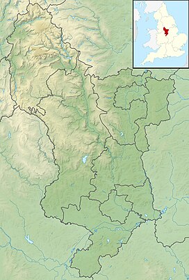
Location of Lantern Pike in Derbyshire | |
| Location | Derbyshire, |
| Parent range | Peak District |
| OS grid | SK026881 |
Lantern Pike is a hill located just outside
National Trust. It is permanently open to the public. According to Ordnance Survey, it is 373 metres (1,224 ft) in height (measured by air survey).[1]
According to the booklet 10 Walks Around Hayfield, published by the Peak District National Park Authority, the name Lantern Pike probably comes from the hill's use as a beacon.
The hill is a popular hiking destination, and is often considered a continuation of nearby Kinder Scout. The Peak District Boundary Walk runs south to north past the summit[2] and the Pennine Bridleway crosses the eastern flank of the hill.[1]
Lantern Pike gives its name to the Lantern Pike Inn in nearby Little Hayfield.[3]
References
- ^ ISBN 978-0319240670. Retrieved 31 July 2012.
- ISBN 978-1909461536.
- ^ "The Lantern Pike Inn". Retrieved 31 July 2012.

