Las Flecheras Airport
Las Flecheras Airport San Fernando De Apure Airport | |||||||||||
|---|---|---|---|---|---|---|---|---|---|---|---|
| |||||||||||
| Coordinates | 7°53′00″N 67°26′40″W / 7.88333°N 67.44444°W | ||||||||||
| Map | |||||||||||
| Runways | |||||||||||
| |||||||||||
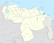
Las Flecheras Airport (Spanish: Aeropuerto Las Flecheras) (IATA: SFD, ICAO: SVSR) is an airport serving the city of San Fernando de Apure, the capital of the Apure state in Venezuela. The runway is just east of the city, along the Apure River.
The San Fernando
Airlines and destinations
| Airlines | Destinations |
|---|---|
| Conviasa | Caracas[6] |
See also
References
- ^ Airport information for SFD at Great Circle Mapper.
- ^ Google Maps - San Fernando
- ^ SFD VOR
- ^ SFD NDB
- ^ SkyVector Aeronautical Charts
- ^ "Venezuela: Conviasa to fly between Caracas and Mérida starting in May". Aviacionaldia.com. 23 April 2023. Retrieved 23 April 2023.
External links
- OpenStreetMap - Las Flecheras
- OurAirports - San Fernando
- SkyVector - San Fernando
- Accident history for SFD at Aviation Safety Network

