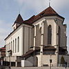
List of cultural property of national significance in Switzerland: Appenzell Innerrhoden
Appearance
This list contains all
canton of Appenzell Innerrhoden from the 2009 Swiss Inventory of Cultural Property of National and Regional Significance. It is sorted by municipality
.
The geographic coordinates provided are in the Swiss coordinate system as given in the Inventory.
Appenzell
| KGS No.? |
Picture | Name | Street Address | CH1903 X coordinate | CH1903 Y coordinate | Location |
|---|---|---|---|---|---|---|
| 333 |  |
Farm House Kuenzes | Lehnstrasse 102 | 749.384 | 245.189 | 47°20′26″N 9°24′56″E / 47.340625°N 9.415503°E
|
| 9907 |  |
Horersjokelis House with Barn | Lehn 76 | 748.971 | 244.987 | 47°20′20″N 9°24′36″E / 47.338902°N 9.409973°E
|
| 342 |  |
Capuchin Monastery Maria der Engel | 748.630 | 244.169 | 47°19′54″N 9°24′19″E / 47.331624°N 9.405191°E
| |
| 8813 |  |
Cantonal Achieves of Appenzell Innerrhoden | Marktgasse 2 | 748.976 | 244.127 | 47°19′52″N 9°24′35″E / 47.331168°N 9.409753°E
|
| 9552 |  |
Medieval / Early Modern Village | 748.400 | 244.000 | 47°19′49″N 9°24′08″E / 47.330156°N 9.402093°E
| |
| 8468 |  |
Museum Appenzell | Hauptgasse 4 | 748.981 | 244.094 | 47°19′51″N 9°24′35″E / 47.33087°N 9.409808°E
|
| 331 |  |
Parish Church of St. Mauritius | Hauptgasse 2 | 749.010 | 244.100 | 47°19′51″N 9°24′37″E / 47.330918°N 9.410194°E
|
| 332 |  |
Rathaus (Town council house) | Hauptgasse 6 | 748.968 | 244.092 | 47°19′51″N 9°24′35″E / 47.330855°N 9.409636°E
|
| 354 |  |
Appenzell Castle | Poststrasse 5 | 748.969 | 243.991 | 47°19′48″N 9°24′35″E / 47.329947°N 9.409615°E
|
| Unknown | ISOS Kleinstadt / Flecken: Appenzell |
Gonten
| KGS No.? |
Picture | Name | Street Address | CH1903 X coordinate | CH1903 Y coordinate | Location |
|---|---|---|---|---|---|---|
| 363 |  |
Bürgerhaus Roothuus | Dorf | 744.254 | 243.752 | 47°19′44″N 9°20′50″E / 47.328846°N 9.347179°E |
Schlatt-Haslen
| KGS No.? |
Picture | Name | Street Address | CH1903 X coordinate | CH1903 Y coordinate | Location |
|---|---|---|---|---|---|---|
| 383 |  |
Farm House Ulrichlis | Lank | 747.904 | 246.034 | 47°20′55″N 9°23′46″E / 47.348556°N 9.396204°E
|
| Unknown | ISOS hamlet: Schlatt |
Schwende-Rüte
| KGS No.? |
Picture | Name | Street Address | CH1903 X coordinate | CH1903 Y coordinate | Location |
|---|---|---|---|---|---|---|
| 370 |  |
Alte Bleiche | Bleichestrasse 8 | 749.623 | 243.824 | 47°19′42″N 9°25′06″E / 47.328297°N 9.418209°E
|
| Unknown | Altwasser-Höhle, Late Paleolithic Shelter |
| ||||
| 371 |  |
Farm House | Blumenau | 750.492 | 242.917 | 47°19′12″N 9°25′46″E / 47.319944°N 9.429397°E
|
| 386 |  Paleolithic Houses / Early Modern Settlement |
Wildkirchli site with Chapel of St. Michael and Paleolithic Houses / Early Modern Settlement |
749.506 | 238.960 | 47°17′05″N 9°24′54″E / 47.284588°N 9.415041°E |
References
- All entries, addresses and coordinates are from: "Kantonsliste A-Objekte". KGS Inventar (in German). Federal Office of Civil Protection. 2009. Archived from the original on 28 June 2010. Retrieved 25 April 2011.
External links
- Swiss Inventory of Cultural Property of National and Regional Significance, 2009 edition:
- "Revision of the PCP Inventory (Revision des KGS-Inventars)". KGS Forum (13/2008). Federal Office of Civil Protection. 2008. Archived from the original on 2011-05-05. Retrieved 2011-04-25.
Wikimedia Commons has media related to Cultural properties of national significance in the canton of Appenzell Innerrhoden.
