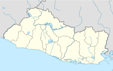
Los Comandos Airport
Los Comandos Airport | |||||||||||
|---|---|---|---|---|---|---|---|---|---|---|---|
| |||||||||||
| Coordinates | 13°43′35″N 88°06′25″W / 13.72639°N 88.10694°W | ||||||||||
| Map | |||||||||||
| Runways | |||||||||||
| |||||||||||
Los Comandos Airport (
San Francisco Gotera in Morazán Department, El Salvador
.
The runway is 3 kilometres (1.9 mi) north of the town. There is rising terrain to the north.
The Soto Cano
VOR-DME (Ident: TNT) is located 54.3 nautical miles (100.6 km) east-northeast of the airstrip.[3][4]
See also
References
- ^ Google Maps - Los Comandos
- ^ Airport information for Los Comandos Airport at Great Circle Mapper.
- ^ Soto Cano VOR
- ^ Toncontin VOR
External links
- OurAirports - Los Comandos
- OpenStreetMap - Los Comandos
- HERE Maps - Los Comandos
- FallingRain - Los Comandos

