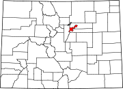
Lowry, Denver
39°43′17″N 104°53′44″W / 39.721448°N 104.895573°W
Lowry is a
Denver U.S. Post Office (ZIP Code 80230) serves the neighborhood.[1] A satellite campus of the University of Northern Colorado also exists in the area.[2]
References
- ^ "ZIP Code Lookup". United States Postal Service. January 3, 2007. Archived from the original (JavaScript/HTML) on November 22, 2010. Retrieved January 3, 2007.
- ^ University of Northern Colorado – UNC Denver Center at Lowry. Retrieved December 25, 2021.

