
Millry, Alabama
Millry, Alabama | ||
|---|---|---|
FIPS code 01-48832 | | |
| GNIS feature ID | 0122846 | |
Millry is a town in
Geography
Millry is located at 31°37′53″N 88°19′8″W / 31.63139°N 88.31889°W (31.631309, -88.318972).[2]
According to the
Demographics
| Census | Pop. | Note | %± |
|---|---|---|---|
| 1950 | 607 | — | |
| 1960 | 645 | 6.3% | |
| 1970 | 911 | 41.2% | |
| 1980 | 956 | 4.9% | |
| 1990 | 781 | −18.3% | |
| 2000 | 615 | −21.3% | |
| 2010 | 546 | −11.2% | |
| 2020 | 450 | −17.6% | |
| U.S. Decennial Census[3] 2013 Estimate[4] | |||
As of the
There were 262 households, out of which 27.1% had children under the age of 18 living with them, 51.1% were married couples living together, 13.4% had a female householder with no husband present, and 33.2% were non-families. 30.9% of all households were made up of individuals, and 15.6% had someone living alone who was 65 years of age or older. The average household size was 2.35 and the average family size was 2.93.
In the town, the population was spread out, with 22.6% under the age of 18, 9.3% from 18 to 24, 23.1% from 25 to 44, 28.0% from 45 to 64, and 17.1% who were 65 years of age or older. The median age was 42 years. For every 100 females, there were 89.2 males. For every 100 females age 18 and over, there were 83.1 males.
The median income for a household in the town was $24,886, and the median income for a family was $32,500. Males had a median income of $36,667 versus $17,917 for females. The
References
- ^ "2020 U.S. Gazetteer Files". United States Census Bureau. Retrieved October 29, 2021.
- ^ "US Gazetteer files: 2010, 2000, and 1990". United States Census Bureau. February 12, 2011. Retrieved April 23, 2011.
- ^ "U.S. Decennial Census". Census.gov. Retrieved June 6, 2013.
- ^ "Annual Estimates of the Resident Population: April 1, 2010 to July 1, 2013". Retrieved June 3, 2014.
- ^ "U.S. Census website". United States Census Bureau. Retrieved January 31, 2008.
31°37′53″N 88°19′08″W / 31.631309°N 88.318972°W
Municipalities and communities of Washington County, Alabama, United States | ||
|---|---|---|
| Towns | 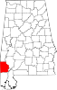 | |
| CDPs | ||
| Unincorporated communities | ||
| Ghost towns | ||
| Indian reservation | ||
| Footnotes | ‡This populated place also has portions in an adjacent county or counties | |
| ||
| Authority control databases: National |
|---|