National Register of Historic Places listings in Presidio County, Texas

This is a list of the National Register of Historic Places in Presidio County, Texas
This is intended to be a complete list of properties and districts listed on the
State Antiquities Landmark
.
This National Park Service list is complete through NPS recent listings posted April 12, 2024.[1]
Current listings
The publicly disclosed locations of National Register properties and districts may be seen in a mapping service provided.[2]
| [3] | Name on the Register[4] | Image | Date listed[5] | Location | City or town | Description |
|---|---|---|---|---|---|---|
| 1 | Blackwell School |  |
December 4, 2019 (#100004751) |
501 South Abbot St. 30°18′21″N 104°01′20″W / 30.3059°N 104.0221°W | Marfa | |
| 2 | Building 98, Fort D.A. Russell |  |
February 25, 2004 (#04000100) |
W. Bonnie St. 30°18′11″N 104°01′39″W / 30.303056°N 104.0275°W | Marfa | Recorded Texas Historic Landmark |
| 3 | Central Marfa Historic District | April 18, 2022 (#100007597) |
Roughly bounded by Washington, Dallas, Dean, Russell, Austin and Abbott Sts. 29°51′43″N 104°20′01″W / 29.861944°N 104.333611°W | Marfa | ||
| 4 | El Fortin del Cibolo Historic District
|
 |
April 6, 1995 (#95000366) |
Approximately 4 mi (6.4 km) northwest of Shafter, west of US 67 29°51′43″N 104°20′01″W / 29.861944°N 104.333611°W | Shafter | Recorded Texas Historic Landmark; now part of Cibolo Creek Ranch |
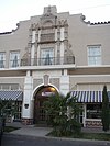
| 5 | El Paisano Hotel |  |
August 1, 1978 (#78002973) |
N. Highland St. and W. Texas St. 30°18′44″N 104°01′19″W / 30.312222°N 104.021944°W | Marfa | Recorded Texas Historic Landmark |
| 6 | Fort D.A. Russell Historic District | December 14, 2006 (#06001152) |
Roughly bounded by Ridge, El Paso, Kelly streets, | Marfa | Now the Chinati Foundation | |
| 7 | Fort Leaton
|
 |
June 18, 1973 (#73001972) |
4 mi (6.4 km) east of Presidio on FM 170 29°32′30″N 104°19′36″W / 29.541667°N 104.326667°W | Presidio | State Historic Site (TPWD) |
| 8 | Fortin de la Cienega
|
 |
October 8, 1976 (#76002059) |
15 mi (24 km) northeast of Shafter on Cienega Creek 29°48′13″N 104°12′41″W / 29.803611°N 104.211389°W | Shafter | Now part of Cibolo Creek Ranch |
| 9 | La Junta de los Rios Archeological District |  |
February 14, 1978 (#78002974) |
Address restricted[6] | Presidio | |
| 10 | La Morita Historic District
|
April 6, 1995 (#95000367) |
Approximately 5 mi (8.0 km) southwest of Shafter, east of US 67 29°46′51″N 104°15′16″W / 29.780833°N 104.254444°W | Shafter | Now part of Cibolo Creek Ranch | |
| 11 | Presidio County Courthouse |  |
December 20, 1977 (#77001467) |
Public Square 30°18′48″N 104°01′20″W / 30.313333°N 104.022222°W | Marfa | State Antiquities Landmark ; Recorded Texas Historic Landmark
|
| 12 | Shafter Historic Mining District
|
 |
May 17, 1976 (#76002058) |
20 mi (32 km) north of Presidio on US 67 29°48′50″N 104°18′24″W / 29.813889°N 104.306667°W | Shafter | |
| 13 | Tapalcomes | March 25, 1977 (#77001468) |
Address restricted[6] | Redford | Polvo site (41PS21) |
See also
- National Register of Historic Places listings in Texas
- List of Texas State Historic Sites
- Recorded Texas Historic Landmarks in Presidio County
References
- ^ National Park Service, United States Department of the Interior, "National Register of Historic Places: Weekly List Actions", retrieved April 12, 2024.
- ^ The latitude and longitude information provided in this table was derived originally from the National Register Information System, which has been found to be fairly accurate for about 99% of listings. Some locations in this table may have been corrected to current GPS standards.
- ^ Numbers represent an alphabetical ordering by significant words. Various colorings, defined here, differentiate National Historic Landmarks and historic districts from other NRHP buildings, structures, sites or objects.
- ^ "National Register Information System". National Register of Historic Places. National Park Service. April 24, 2008.
- ^ The eight-digit number below each date is the number assigned to each location in the National Register Information System database, which can be viewed by clicking the number.
- ^ OCLC 20706997.
External links
![]() Media related to National Register of Historic Places in Presidio County, Texas at Wikimedia Commons
Media related to National Register of Historic Places in Presidio County, Texas at Wikimedia Commons


