
Nieuwdorp
Nieuwdorp | ||
|---|---|---|
Village | ||
Postal code 4455[1] | ||
| Dialing code | 0113 | |
Nieuwdorp is a village in the Dutch province of Zeeland. It is a part of the municipality of Borsele, and lies about 9 km east of Middelburg.
History
The village was first mentioned around 1750 as Het Nieuwe Dorp, and means "new village". Nieuw (new) has been added to distinguish from 's-Heer Arendskerke which was colloquially called Oudedorp.[3] Nieuwdorp is a dike village which appeared after the West-Kraayertpolder was poldered in 1642 and Nieuwe Kraayertpolder was added in 1675. The village is centred around a large square.[4]
The
Nieuwdorp was home to 388 people in 1840. Nieuwdorp used to be part of the municipality of 's-Heer Arendskerke. In 1970, it became part of the municipality of Borsele.[5] In 2009, the Liberation Museum Zeeland opened and provides an overview of World War II in the province of Zeeland with an emphasis on the Battle of the Scheldt.[5]
Gallery
-
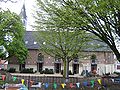 Church of Nieuwdorp
 -
 Farm in Nieuwdorp
 -
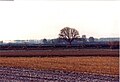 Landscape near Nieuwdorp


References
- ^ a b c "Kerncijfers wijken en buurten 2021". Central Bureau of Statistics. Retrieved 19 April 2022.
- ^ "Postcodetool for 4455AA". Actueel Hoogtebestand Nederland (in Dutch). Het Waterschapshuis. Retrieved 19 April 2022.
- ^ "Nieuwdorp - (geografische naam)". Etymologiebank (in Dutch). Retrieved 19 April 2022.
- ^ ISBN 90 400 8830 6. Retrieved 19 April 2022.
- ^ a b "Nieuwdorp". Plaatsengids (in Dutch). Retrieved 19 April 2022.