Okstindan
| Okstindan | |
|---|---|
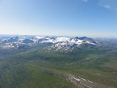
 Seen from Litjfjellet by Drevvatn | |
| Highest point | |
| Peak | Oksskolten, Hemnes, Nordland, Norway |
| Elevation | 1,916 m (6,286 ft) |
| Coordinates | 66°00′44″N 14°20′19″E / 66.0122°N 14.3386°E |
| Geography | |
| Location | Nordland, Norway |
| Range coordinates | 66°00′00″N 14°17′37″E / 66.0001°N 14.2937°E[1] |
Okstindan is a
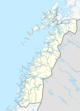
North Norway. Other mountains in the range include Okstinden, Okshornet, Vesttinden, and Bessedørtinden. Between these mountains lies the large glacier Okstindbreen. The Swedish border lies just to the east of the mountains.[2]
The most common starting point for tours of the Okstindan mountains is from the Leirskardalen valley or the lake Kjennsvannet in Hemnes.
Media gallery
-
Okstindan, Nordland, Norway
-
View of the mountains from Sweden
References
- ^ "Okstindan, Hemnes (Nordland)" (in Norwegian). yr.no. Retrieved 2019-02-16.
- Store norske leksikon. "Okstindane"(in Norwegian). Retrieved 2011-12-02.


