
Oploo
Oploo | ||
|---|---|---|
Postal code 5841[1] | ||
| Dialing code | 0485 | |
Oploo is a village in the Dutch province of North Brabant. It is located in the former municipality of Sint Anthonis. Since 2022 it has been part of the new municipality of Land van Cuijk.
History
Oploo developed in the valley of a brook in the 12th or 13th century. There used to be two castle near Oploo, but both have disappeared. Of Bekenstein castle a farm remains with 16th century elements.[3]
The
Oploo was a separate municipality until 1821, when it merged with Sint Anthonis en Ledeacker to form the new municipality of Oploo, Sint Anthonis en Ledeacker.[5] Oploo was home to 482 people in 1840.[6] In 2022, it became part of the municipality of Land van Cuijk.[6]
Gallery
-
 Church in Oploo
 -
 Farm in Oploo
 -
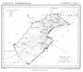 Map of 1865


References
- ^ a b c "Kerncijfers wijken en buurten 2021". Central Bureau of Statistics. Retrieved 17 April 2022.
- ^ "Postcodetool for 5841AA". Actueel Hoogtebestand Nederland (in Dutch). Het Waterschapshuis. Retrieved 17 April 2022.
- ISBN 90 400 9945 6. Retrieved 17 April 2022.
- ^ "De Korenbloem". Molen database (in Dutch). Retrieved 17 April 2022.
- ^ Ad van der Meer and Onno Boonstra, Repertorium van Nederlandse gemeenten, KNAW, 2011.
- ^ a b "Oploo". Plaatsengids (in Dutch). Retrieved 17 April 2022.
| International | |
|---|---|
| National | |
This North Brabant location article is a stub. You can help Wikipedia by expanding it. |