
Palmas, Arroyo, Puerto Rico
Palmas | |
|---|---|
Barrio | |
UTC−4 (AST ) |
Palmas is a barrio in the municipality of Arroyo, Puerto Rico. Its population in 2010 was 3,789.[3][4][5]
History
Palmas was in Spain's
Treaty of Paris of 1898 and became an unincorporated territory of the United States. In 1899, the United States Department of War conducted a census of Puerto Rico finding that combined the population of Palmas, Ancones and Guásimas barrios was 596.[7]
| Census | Pop. | Note | %± |
|---|---|---|---|
| 1910 | 481 | — | |
| 1920 | 580 | 20.6% | |
| 1930 | 656 | 13.1% | |
| 1940 | 1,247 | 90.1% | |
| 1950 | 1,398 | 12.1% | |
| 1960 | 1,780 | 27.3% | |
| 1970 | 1,289 | −27.6% | |
| 1980 | 2,361 | 83.2% | |
| 1990 | 3,167 | 34.1% | |
| 2000 | 4,090 | 29.1% | |
| 2010 | 3,789 | −7.4% | |
| U.S. Decennial Census 1900 (N/A)[8] 1910-1930[9] 1930-1950[10] 1980-2000[11] 2010[12] | |||
Special Community
Since 2001 when law 1-2001 was passed,[13] measures have been taken to identify and address the high levels of poverty and the lack of resources and opportunities affecting specific communities in Puerto Rico.[14] By 2008, there were 742 places on the list of Comunidades especiales de Puerto Rico of barrios, communities, sectors, or neighborhoods and in 2004, Palmas barrio made the list.[15][16]
Gallery
-
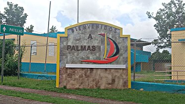 Welcome to Palmas sign

See also
References
- ^ a b "US Gazetteer 2019". US Census. US Government.
- ^ U.S. Geological Survey Geographic Names Information System: Palmas barrio
- ^ Picó, Rafael; Buitrago de Santiago, Zayda; Berrios, Hector H. Nueva geografía de Puerto Rico: física, económica, y social, por Rafael Picó. Con la colaboración de Zayda Buitrago de Santiago y Héctor H. Berrios. San Juan Editorial Universitaria, Universidad de Puerto Rico,1969.
- ISBN 978-1-4766-0447-3. Retrieved 25 December 2018.
- ^ Puerto Rico: 2010 Population and Housing Unit Counts.pdf (PDF). U.S. Dept. of Commerce, Economics and Statistics Administration, U.S. Census Bureau. 2010.
- ^ "Anuario del comercio, de la industria, de la magistratura y de la administración. 1881". Biblioteca Nacional de España (in Spanish). p. 1614. Retrieved 4 April 2023.
- ^ Joseph Prentiss Sanger; Henry Gannett; Walter Francis Willcox (1900). Informe sobre el censo de Puerto Rico, 1899, United States. War Dept. Porto Rico Census Office (in Spanish). Imprenta del gobierno. p. 165.
- ^ "Report of the Census of Porto Rico 1899". War Department Office Director Census of Porto Rico. Archived from the original on July 16, 2017. Retrieved September 21, 2017.
- ^ "Table 3-Population of Municipalities: 1930 1920 and 1910" (PDF). United States Census Bureau. Archived (PDF) from the original on August 17, 2017. Retrieved September 21, 2017.
- ^ "Table 4-Area and Population of Municipalities Urban and Rural: 1930 to 1950" (PDF). United States Census Bureau. Archived (PDF) from the original on August 30, 2015. Retrieved September 21, 2014.
- ^ "Table 2 Population and Housing Units: 1960 to 2000" (PDF). United States Census Bureau. Archived (PDF) from the original on July 24, 2017. Retrieved September 21, 2017.
- ^ Puerto Rico: 2010 Population and Housing Unit Counts.pdf (PDF). U.S. Dept. of Commerce Economics and Statistics Administration U.S. Census Bureau. 2010. Archived (PDF) from the original on 2017-02-20. Retrieved 2019-08-02.
- ^ "Leyes del 2001". Lex Juris Puerto Rico (in Spanish). Retrieved 24 June 2019.
- ^ "Comunidades Especiales de Puerto Rico" (in Spanish). 8 August 2011. Retrieved 24 June 2019.
- ^ "Evoluciona el proyecto de Comunidades Especiales". El Nuevo Dia (in Spanish). 24 February 2017. Retrieved 24 June 2019.
- ^ "Ya es ley Oficina para el Desarrollo Socioeconómico y Comunitario". El Vocero de Puerto Rico (in Spanish). Retrieved 24 June 2019.
External links
This Arroyo, Puerto Rico location article is a stub. You can help Wikipedia by expanding it. |