
Perchas 2
Perchas 2 | |
|---|---|
Barrio | |
UTC−4 (AST ) |
Perchas 2 is a barrio in the municipality of San Sebastián, Puerto Rico. Its population in 2010 was 988.[3][4][5]
History
Perchas 2 was in Spain's
Treaty of Paris of 1898 and became an unincorporated territory of the United States. In 1899, the United States Department of War conducted a census of Puerto Rico finding that the combined population of Perchas 1 and Perchas 2 barrios was 1,429.[7]
| Census | Pop. | Note | %± |
|---|---|---|---|
| 1910 | 972 | — | |
| 1920 | 1,066 | 9.7% | |
| 1930 | 1,082 | 1.5% | |
| 1940 | 971 | −10.3% | |
| 1950 | 1,049 | 8.0% | |
| 1960 | 1,118 | 6.6% | |
| 1970 | 682 | −39.0% | |
| 1980 | 814 | 19.4% | |
| 1990 | 945 | 16.1% | |
| 2000 | 1,072 | 13.4% | |
| 2010 | 988 | −7.8% | |
| U.S. Decennial Census 1900 (N/A)[8] 1910-1930[9] 1930-1950[10] 1980-2000[11] 2010[12] | |||
Sectors
Barrios (which are roughly comparable to
minor civil divisions)[13] in turn are further subdivided into smaller local populated place areas/units called sectores (sectors in English). The types of sectores may vary, from normally sector to urbanización to reparto to barriada to residencial, among others.[14][15][16]
The following sectors are in Perchas 2 barrio:[17]
Carretera 124, Carretera 435, Comunidad Alturas de Borinquén, Parcelas García Méndez, Sector Ángel Ríos, Sector Entrada Oronoz, Sector Finca Los Abuelos, Sector Genaro Vélez, Sector Lito Rodríguez, Sector Olavarría, Sector Pablo Fernández, Sector Pelo Muerto, Sector Perfecto Rodríguez, Sector Parcelas González, Sector Pulio Rodríguez, Sector Santo Domingo, and Sector Tosquera.
Gallery
Scenes in Perchas 2:
-
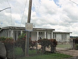 Home in Sector Olavarría
 -
 Stream in Sector Santo Domingo
 -
 Sector Santo Domingo
 -
 Bamboo in Sector Santo Domingo
 -
 Sector Santo Domingo
 -
 Breadfruit tree in Sector Santo Domingo
 -
 Sector Santo Domingo


See also
References
- ^ a b "US Gazetteer 2019". US Census. US Government.
- ^ U.S. Geological Survey Geographic Names Information System: Perchas 2 barrio
- ^ Picó, Rafael; Buitrago de Santiago, Zayda; Berrios, Hector H. Nueva geografía de Puerto Rico: física, económica, y social, por Rafael Picó. Con la colaboración de Zayda Buitrago de Santiago y Héctor H. Berrios. San Juan Editorial Universitaria, Universidad de Puerto Rico,1969.
- ISBN 978-1-4766-0447-3. Retrieved 25 December 2018.
- ^ Puerto Rico: 2010 Population and Housing Unit Counts.pdf (PDF). U.S. Dept. of Commerce, Economics and Statistics Administration, U.S. Census Bureau. 2010.
- ^ "Anuario del comercio, de la industria, de la magistratura y de la administración. 1881". Biblioteca Nacional de España (in Spanish). p. 1614. Retrieved 4 April 2023.
- ^ Joseph Prentiss Sanger; Henry Gannett; Walter Francis Willcox (1900). Informe sobre el censo de Puerto Rico, 1899, United States. War Dept. Porto Rico Census Office (in Spanish). Imprenta del gobierno. p. 160.
- ^ "Report of the Census of Porto Rico 1899". War Department Office Director Census of Porto Rico. Archived from the original on July 16, 2017. Retrieved September 21, 2017.
- ^ "Table 3-Population of Municipalities: 1930 1920 and 1910" (PDF). United States Census Bureau. Archived (PDF) from the original on August 17, 2017. Retrieved September 21, 2017.
- ^ "Table 4-Area and Population of Municipalities Urban and Rural: 1930 to 1950" (PDF). United States Census Bureau. Archived (PDF) from the original on August 30, 2015. Retrieved September 21, 2014.
- ^ "Table 2 Population and Housing Units: 1960 to 2000" (PDF). United States Census Bureau. Archived (PDF) from the original on July 24, 2017. Retrieved September 21, 2017.
- ^ Puerto Rico: 2010 Population and Housing Unit Counts.pdf (PDF). U.S. Dept. of Commerce Economics and Statistics Administration U.S. Census Bureau. 2010. Archived (PDF) from the original on 2017-02-20. Retrieved 2019-08-02.
- ^ "US Census Barrio-Pueblo definition". factfinder.com. US Census. Archived from the original on 13 May 2017. Retrieved 5 January 2019.
- ^ "Agencia: Oficina del Coordinador General para el Financiamiento Socioeconómico y la Autogestión (Proposed 2016 Budget)". Puerto Rico Budgets (in Spanish). Retrieved 28 June 2019.
- ISBN 978-0-9820806-1-0
- ^ "Leyes del 2001". Lex Juris Puerto Rico (in Spanish). Retrieved 24 June 2020.
- ^ "PRECINTO ELECTORAL SAN SEBASTIÁN 033" (PDF). Comisión Estatal de Elecciones (in Spanish). PR Government. 19 October 2018. Retrieved 19 June 2019.
This San Sebastián, Puerto Rico location article is a stub. You can help Wikipedia by expanding it. |