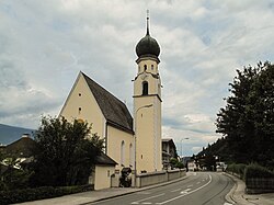
Pill, Tyrol
Pill | ||
|---|---|---|
 Church of Saint Anne | ||
|
Postal code 6130 | ||
| Area code | 05242 | |
| Vehicle registration | SZ | |
| Website | www.pill.tirol.gv.at | |
Pill is a
Tyrol
.
The 2024 Tour of the Alps passed through Pill on the 16th of April. [3]
Geography
Pill lies in the Lower Inn Valley near Schwaz.
References
- ^ "Dauersiedlungsraum der Gemeinden Politischen Bezirke und Bundesländer - Gebietsstand 1.1.2018". Statistics Austria. Retrieved 10 March 2019.
- ^ "Einwohnerzahl 1.1.2018 nach Gemeinden mit Status, Gebietsstand 1.1.2018". Statistics Austria. Retrieved 9 March 2019.
- ^ https://www.discoveryplus.com/gb/video/sport/dplus-sport-dplus-sport-sport/tour-of-the-alps-stage-2
Wikimedia Commons has media related to Pill, Tyrol.
