
Prožura
Prožura | |
|---|---|
Village | |
UTC+2 (CEST ) |
Prožura is a village on the island of
D120 highway
. its geographical coordinates are 42° 43' 43" North, 17° 38' 58" East and its original name (with diacritics) is Prožura.
Demographics
According to the 2021 census, its population was 26.[2]
Gallery
-
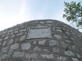
 Tower
Tower -
 St. Martin's Church
 -
 St. Roch's Church
 -
 Memorial of Mato Gracić


References
- Wikidata Q119585703.
- ^ a b "Population by Age and Sex, by Settlements, 2021 Census". Census of Population, Households and Dwellings in 2021. Zagreb: Croatian Bureau of Statistics. 2022.
This Dubrovnik-Neretva County geography article is a stub. You can help Wikipedia by expanding it. |