
Río Grande, Morovis, Puerto Rico
Río Grande | |
|---|---|
Barrio | |
UTC−4 (AST) | |
| ZIP Code | 00687 |
Río Grande is a barrio in the municipality of Morovis, Puerto Rico. Río Grande has six sectors and its population in 2010 was 594.[3][4][5]
History
Río Grande was in Spain's

Río Grande was flooded when Hurricane Maria struck on September 20, 2017. The Río Grande River destroyed many homes and came up as high as 2 feet under La Playita restaurant, which is a restaurant on stilts. The people in the community were left isolated and without power.[8]
| Census | Pop. | Note | %± |
|---|---|---|---|
| 1900 | 841 | — | |
| 1910 | 936 | 11.3% | |
| 1920 | 911 | −2.7% | |
| 1930 | 1,019 | 11.9% | |
| 1940 | 1,210 | 18.7% | |
| 1950 | 1,187 | −1.9% | |
| 1960 | 967 | −18.5% | |
| 1970 | 657 | −32.1% | |
| 1980 | 592 | −9.9% | |
| 1990 | 535 | −9.6% | |
| 2000 | 645 | 20.6% | |
| 2010 | 594 | −7.9% | |
| U.S. Decennial Census 1899 (shown as 1900)[9] 1910-1930[10] 1930-1950[11] 1980-2000[12] 2010[13] | |||
Sectors
Barrios (which are, in contemporary times, roughly comparable to
The following sectors are in Río Grande barrio:[18]
Sector Delgado, Sector El Cerro, Sector Fontán, Sector La Playita, Sector Los Quendo, and Tramo Carretera 155.
Gallery
- Scenes around Río Grande, Morovis
-
 View from bridge in Sector La Playita
 -
 Sector La Playita
 -
 Río Grande sign onPR-155
 -
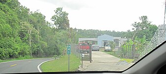 PR-155 at km 41 southbound towards Orocovis
 -
 PR-155 at km 40.8 southbound approaching Orocovis


See also
References
- ^ a b "US Gazetteer 2019". US Census. US Government.
- ^ U.S. Geological Survey Geographic Names Information System: Río Grande barrio
- ^ Picó, Rafael; Buitrago de Santiago, Zayda; Berrios, Hector H. Nueva geografía de Puerto Rico: física, económica, y social, por Rafael Picó. Con la colaboración de Zayda Buitrago de Santiago y Héctor H. Berrios. San Juan Editorial Universitaria, Universidad de Puerto Rico,1969.
- ISBN 978-1-4766-0447-3. Retrieved 25 December 2018.
- ^ Puerto Rico: 2010 Population and Housing Unit Counts.pdf (PDF). U.S. Dept. of Commerce, Economics and Statistics Administration, U.S. Census Bureau. 2010.
- ^ "Anuario del comercio, de la industria, de la magistratura y de la administración. 1881". Biblioteca Nacional de España (in Spanish). p. 1614. Retrieved 4 April 2023.
- ^ Joseph Prentiss Sanger; Henry Gannett; Walter Francis Willcox (1900). Informe sobre el censo de Puerto Rico, 1899, United States. War Dept. Porto Rico Census Office (in Spanish). Imprenta del gobierno. p. 161.
- ^ Ortega Marrero, Melisa (23 September 2017). "Morovis: "Esto es como una pesadilla"" [Morovis:"This is like a nightmare"]. Primera Hora (in Spanish).
- ^ "Report of the Census of Porto Rico 1899". War Department Office Director Census of Porto Rico. Archived from the original on July 16, 2017. Retrieved September 21, 2017.
- ^ "Table 3-Population of Municipalities: 1930 1920 and 1910" (PDF). United States Census Bureau. Archived (PDF) from the original on August 17, 2017. Retrieved September 21, 2017.
- ^ "Table 4-Area and Population of Municipalities Urban and Rural: 1930 to 1950" (PDF). United States Census Bureau. Archived (PDF) from the original on August 30, 2015. Retrieved September 21, 2014.
- ^ "Table 2 Population and Housing Units: 1960 to 2000" (PDF). United States Census Bureau. Archived (PDF) from the original on July 24, 2017. Retrieved September 21, 2017.
- ^ Puerto Rico: 2010 Population and Housing Unit Counts.pdf (PDF). U.S. Dept. of Commerce Economics and Statistics Administration U.S. Census Bureau. 2010. Archived (PDF) from the original on 2017-02-20. Retrieved 2019-08-02.
- ^ "US Census Barrio-Pueblo definition". factfinder.com. US Census. Archived from the original on 13 May 2017. Retrieved 5 January 2019.
- ^ "Agencia: Oficina del Coordinador General para el Financiamiento Socioeconómico y la Autogestión (Proposed 2016 Budget)". Puerto Rico Budgets (in Spanish). Retrieved 28 June 2019.
- ISBN 978-0-9820806-1-0
- ^ "Leyes del 2001". Lex Juris Puerto Rico (in Spanish). Retrieved 24 June 2020.
- ^ "PRECINTO ELECTORAL MOROVIS 020" (PDF). Comisión Estatal de Elecciones (in Spanish). PR Government. 8 October 2019. Retrieved 24 June 2020.
External links
 Media related to Río Grande at Wikimedia Commons
This Morovis, Puerto Rico location article is a stub. You can help Wikipedia by expanding it. |