
RCAF Station Aylmer
| RCAF Station Aylmer | |
|---|---|
W/C Lew Ingram - 1943 | |
| Garrison | No. 14 Service Flying Training School No. 1 Flight Engineers School Women's Division Service Police School |
| RCAF Station Aylmer | |
|---|---|
| Role | |
RCAF Station Aylmer was a Royal Canadian Air Force airfield that was built between late 1940 and June 1941 northeast of Aylmer, Ontario.[1][2][3] It was one of many built across Canada under the British Commonwealth Air Training Plan during World War II.
The first school at the airfield was No. 14 Service Flying Training School (SFTS). RCAF staff began arriving at the station before construction was finished. First to arrive was a 17-man security party under Sgt. Les Oliver in late March. Squadron Leader T. Moreton, the first officer, arrived on 2 June 1941 to manage the new station's equipment.
Opening ceremonies were held on 2 August 1941 with the Lieutenant Governor of Ontario
Relief airfields were R1—

Other schools located at Aylmer include:
- Women's Division Service Police School (1942)
- No. 1 Flight Engineers' School (1 July 1944 – 31 March 1945).
Aerodrome information
The airfield was constructed in a typical BCATP wartime pattern, with six runways formed in an overlaid triangle. In approximately 1942 the aerodrome was listed at 42°49′N 80°57′W / 42.817°N 80.950°W with a Var. 5 degrees W and elevation of 775 feet (236 m). Six runways were listed as follows: [4]
| Runway Name | Length | Width | Surface |
|---|---|---|---|
| 4/22 | 2,600 feet (792 m) | 100 feet (30 m) | Hard surfaced |
| 4/22 | 2,600 feet (792 m) | 100 feet (30 m) | Hard surfaced |
| 9/27 | 2,600 feet (792 m) | 100 feet (30 m) | Hard surfaced |
| 9/27 | 2,600 feet (792 m) | 100 feet (30 m) | Hard surfaced |
| 15/33 | 2,600 feet (792 m) | 100 feet (30 m) | Hard surfaced |
| 15/33 | 2,600 feet (792 m) | 100 feet (30 m) | Hard surfaced |
Relief landing field – Yarmouth Centre
The primary relief landing field (R1) for RCAF Station Aylmer was Yarmouth Centre, located east of St. Thomas. The Relief field was laid out in the standard triangular pattern. In approximately 1942 the aerodrome was listed as RCAF Aerodrome - St. Thomas, Ontario at 42°46′N 81°07′W / 42.767°N 81.117°W with a Var. 5 degrees W and elevation of 760 feet (232 m). Three runways were listed as follows: [5]
| Runway Name | Length | Width | Surface |
|---|---|---|---|
| 15/33 | 2,600 feet (792 m) | 100 feet (30 m) | Hard Surfaced |
| 9/27 | 2,600 feet (792 m) | 100 feet (30 m) | Hard Surfaced |
| 3/21 | 2,600 feet (792 m) | 100 feet (30 m) | Hard Surfaced |
The Yarmouth Centre airfield now operates as the St. Thomas Municipal Airport.
Relief landing field – Tillsonburg
The secondary Relief Landing Field (R2) for RCAF Station Aylmer was located north-west of the community of Tillsonburg. In approximately 1942 the aerodrome was listed at 42°55′30″N 80°45′00″W / 42.92500°N 80.75000°W as a "Turf - All-way field - Under Construction" no elevation, variation, or runway specifications were listed.[6]
Postwar
RCAF Aylmer continued operations after the war's end and was home to a variety of training facilities:
- Technical and Engineering School (later redesignated No. 1 Technical Training School or TTS) (April 1945 – May 1955)
- Academic Training School (ATS) (May 1949 – October 1950)
- No. 2 Composite Training School (No. 2 KTS)
- No. 11 Examination Unit (September 1951 – November 1952)
- Aeronautical Engineering School (June 1952 – November 1953)
- GCA (Ground Control Approach) School (1953 – 1957)
- Fire-Fighting School (1951 – 1961)
- Support Services School (1960)
No. 2 Manning Depot and No. 1 Personnel Selection Unit (PSU) were located at Aylmer from 1949 – 1950.
The station closed in 1961 and the Ontario Police College eventually took over the facilities. All that remains from the RCAF days are 2 hangars, the deteriorating airfield and the taxi area, which is now used as part of the police vehicle driver training track. Outline of one of the former runways exists in what is now Alymer Wildlife Area. A memorial to the former RCAF station sits at the entrance to the Ontario Police College property.
Remembrance
Twelve flying instructors and 26 students lost their lives training at No. 14 SFTS.[3]
RCAF Aylmer scenes
-
 Historical plaque
 -
 Memorial wind tee
 -
 Ontario Police College sign
 -
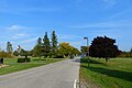 Entrance roadway


References
- ISBN 0660114437>
- ^ Military Bruce Historical Writings by Bruce Forsyth Archived 2013-10-23 at the Wayback Machine
- ^ ISBN 0-920610-00-5
- ^ Staff writer (c. 1942). Pilots Handbook of Aerodromes and Seaplane Bases Vol. 1. Royal Canadian Air Force. p. 95.
- ^ Staff writer (c. 1942). Pilots Handbook of Aerodromes and Seaplane Bases Vol. 1. Royal Canadian Air Force. p. 164.
- ^ Staff writer (c. 1942). Pilots Handbook of Aerodromes and Seaplane Bases Vol. 1. Royal Canadian Air Force. p. 165(b).
External links
- "Harvards Above" by Gananoque Historical Society Retrieved: 2016-11-21