
Rockham, South Dakota
Rockham, South Dakota | ||
|---|---|---|
FIPS code 46-55540[5] | | |
| GNIS feature ID | 1267553[3] | |
Rockham is a town in
History
Rockham was platted in 1886.[7] It was named after Rockhampton, in Australia.[7] A post office has been in operation in Rockham since 1887.[8]
The
Rockham was founded as a stop on the railway that year, in 1886 on land originally homesteaded by Anders Opperud, and was incorporated on March 4, 1909. Rockham's first school, the F.M. Brown School, was erected in 1884; the Rockham Public School was built in 1915. Rockham received its first telephone service in 1903 and electrical power was distributed throughout the city in 1919. [10]In 1925, the Rockham Public School was damaged by a tornado.[11]
In 1970, the
The Rockham Public School closed in 1972.
Rockham celebrated its centennial on July 4–6, 1986.
Geography
According to the United States Census Bureau, the town has a total area of 0.50 square miles (1.29 km2), all land.[13]
Demographics
| Census | Pop. | Note | %± |
|---|---|---|---|
| 1910 | 286 | — | |
| 1920 | 347 | 21.3% | |
| 1930 | 288 | −17.0% | |
| 1940 | 220 | −23.6% | |
| 1950 | 113 | −48.6% | |
| 1960 | 197 | 74.3% | |
| 1970 | 60 | −69.5% | |
| 1980 | 52 | −13.3% | |
| 1990 | 48 | −7.7% | |
| 2000 | 53 | 10.4% | |
| 2010 | 33 | −37.7% | |
| 2020 | 22 | −33.3% | |
| U.S. Decennial Census[14][4] | |||
2010 census
As of the
There were 13 households, of which 23.1% had children under the age of 18 living with them, 46.2% were married couples living together, and 53.8% were non-families. 38.5% of all households were made up of individuals, and 15.4% had someone living alone who was 65 years of age or older. The average household size was 2.54 and the average family size was 4.00.
The median age in the town was 34.5 years. 36.4% of residents were under the age of 18; 0.0% were between the ages of 18 and 24; 15.2% were from 25 to 44; 27.4% were from 45 to 64; and 21.2% were 65 years of age or older. The gender makeup of the town was 60.6% male and 39.4% female.
2000 census
As of the
There were 18 households, out of which 38.9% had children under the age of 18 living with them, 77.8% were married couples living together, and 22.2% were non-families. 22.2% of all households were made up of individuals, and 5.6% had someone living alone who was 65 years of age or older. The average household size was 2.94 and the average family size was 3.43.
In the town, the population was spread out, with 30.2% under the age of 18, 1.9% from 18 to 24, 35.8% from 25 to 44, 15.1% from 45 to 64, and 17.0% who were 65 years of age or older. The median age was 36 years. For every 100 females, there were 112.0 males. For every 100 females age 18 and over, there were 105.6 males.
The median income for a household in the town was $35,625, and the median income for a family was $68,750. Males had a median income of $23,750 versus $16,667 for females. The per capita income for the town was $19,511. None of the population and none of the families were below the poverty line.
References
- ^ "SD Towns" (PDF). South Dakota State Historical Society. Retrieved February 15, 2010.
- ^ "ArcGIS REST Services Directory". United States Census Bureau. Retrieved October 15, 2022.
- ^ a b U.S. Geological Survey Geographic Names Information System: Rockham, South Dakota
- ^ a b "Census Population API". United States Census Bureau. Retrieved October 15, 2022.
- ^ a b "U.S. Census website". United States Census Bureau. Retrieved January 31, 2008.
- ^ "U.S. Census Bureau: Rockham town, South Dakota". www.census.gov. United States Census Bureau. Retrieved March 25, 2022.
- ^ a b Chicago and North Western Railway Company (1908). A History of the Origin of the Place Names Connected with the Chicago & North Western and Chicago, St. Paul, Minneapolis & Omaha Railways. p. 119.
- ^ "Faulk County". Jim Forte Postal History. Retrieved March 26, 2015.
- ^ "Archived copy" (PDF). Archived from the original (PDF) on November 11, 2013. Retrieved November 11, 2013.
{{cite web}}: CS1 maint: archived copy as title (link) | p=80 - ^ South Dakota Senate Concurrent Resolution No. 29, adopted February 19, 1986; Concurred in by the South Dakota House of Representatives February 19, 1986.
- ^ Rockham Centennial, Rockham, S.D., Revisit Rockham July 4, 5, and 6, 1886-1986. The Redfield Press. 1986. p. 40.
- ^ http://history.sd.gov/Preservation/OtherServices/SDRailroad.pdf%7C p = 87
- ^ "US Gazetteer files 2010". United States Census Bureau. Archived from the original on January 25, 2012. Retrieved June 21, 2012.
- ^ "Census of Population and Housing". Census.gov. Retrieved June 4, 2015.
- ^ "U.S. Census website". United States Census Bureau. Retrieved June 21, 2012.
Municipalities and communities of Faulk County, South Dakota, United States | ||
|---|---|---|
| City | 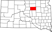 | |
| Towns | ||
| CDPs | ||
| Unincorporated communities | ||
| ||