Romsdalsalpane
Appearance
| Romsdalsalpane | |
|---|---|
| Romsdal Alps ( Store Venjetind | |
| Elevation | 1,852 m (6,076 ft) |
| Coordinates | 62°30′27″N 7°50′23″E / 62.5075°N 7.8397°E |
| Geography | |
| Location | Møre og Romsdal, Norway |
| Range coordinates | 62°25′N 7°51′E / 62.417°N 7.850°E |
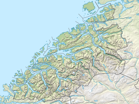
Romsdalsalpane (Fjord Municipality. The southern part of the mountain range is also located within Reinheimen National Park. The famous Trollstigen road runs over a pass in this mountain range.[1]
Mountains in the range include:
- Store Venjetindat 1,852 metres (6,076 ft)
- Store Trolltind at 1,788 metres (5,866 ft), the highest point along the Troll Wall ridge
- Trollryggen at 1,740 metres (5,710 ft)
- Romsdalshornat 1,550 metres (5,090 ft)
- Kyrkjetaket at 1,439 metres (4,721 ft)
See also
- List of mountains of Norway
References
- ^ "Welcome to the Romsdal alps". Retrieved 2010-10-26.


