
Samaná Peninsula
Península de Samaná | |
|---|---|
 | |
 Península de Samaná | |
| Coordinates: 19°15′01″N 69°25′16″W / 19.250219°N 69.421234°Wn | |
| Country | Dominican Republic |
| Population (2008) | |
| • Total | 241,104 |
The Samaná Península is a
beaches, especially in the city of Santa Bárbara de Samaná. It contains three rivers. The peninsula was originally inhabited by the Ciguayos, which spoke the Ciguayo language at the time of Spanish intervention.[1]
Transportation
The main roads are the
DR-5 and the Samaná Highway, which leads from the peninsula to Santo Domingo. The peninsula also contains the Samaná El Catey International Airport
. The peninsula also hosts agriculture and tourism.
Gallery
-
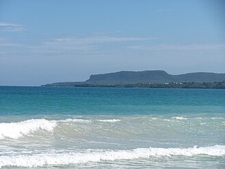 Cabo Samaná, at the eastern end of the peninsula
 -
 El Limon area of Samana, Dominican Republic

.jpg)
See also
References
External links
This Dominican Republic location article is a stub. You can help Wikipedia by expanding it. |