
San Luis Reservoir
| San Luis Reservoir | |
|---|---|
dam3) | |
| Surface elevation | 544 ft (166 m) |
| References | U.S. Geological Survey Geographic Names Information System: San Luis Reservoir |

The San Luis Reservoir is an
Completed in 1967 on land formerly part of
San Luis Reservoir also supplies water to 63,500 acres (25,700 ha) of land in the Santa Clara Valley west of the Coast Ranges.[2] San Justo Dam stores water diverted from San Luis Reservoir through the Pacheco Tunnel and Hollister Conduit, which travel through the Diablo Range.[3] The Santa Clara Tunnel and Santa Clara Conduit convey water to the Coyote Pumping Station in the Santa Clara Valley.[2][4]
History
San Luis Reservoir State Recreation Area

San Luis Reservoir is part of the larger San Luis Reservoir State Recreation Area (California State Parks) and therefore offers many recreational opportunities for fishermen, boaters, and campers. The park is patrolled by California State Park Peace Officers by vehicle, vessel, and off-highway vehicle. In addition to camping and boating, day use picnic areas are available at San Luis Creek, and an off-highway vehicle (OHV) area is available east of the main area at the intersection of Gonzaga Road and Jaspar-Sears Road.
Camping is available at four campgrounds.
- The Basalt Campground on the south-eastern edge of the lake with 79 developed family campsites. Water faucets are available nearby, and some sites can handle RV's to a length of 40 feet (12 m).
- San Luis Creek Campground on O'Neill Forebay with 53 sites with water and electric hook-ups.
- Medeiros Campground has primitive campsites along the southern shoreline of O'Neill Forebay. This campground has drinking water at three locations and chemical toilets.
- Los Banos Creek Campground has primitive campsites and limited turn-around space. It is not suitable for trailers or motor homes. Drinking water and chemical toilets are available.
Improved boat launch ramps are offered at
. The California Office of Environmental Health Hazard Assessment (OEHHA) has developed a safe eating advisory for fish caught in the San Luis Reservoir based on levels of mercury or PCBs found in local species.[5] The lake is noted for its high winds and has wind warning lights at Romero Outlook, Basalt Campground, and Quien Sabe Point.Climate

The National Weather Service has maintained a cooperative weather station at San Luis Dam since 1963. Based on those records, average January temperatures are a maximum of 54.3 °F (12.4 °C) and a minimum of 37.9 °F (3.3 °C) and average July temperatures are a maximum of 92 °F (33 °C) and a minimum of 64.0 °F. There are an average of 69.3 days with highs of 90 °F (32 °C) or higher and an average of 14.1 days with lows of 32 °F (0 °C) or lower. The record high temperature was 110 °F (43 °C) on July 24, 2006, and the record low temperature was 14 °F (−10 °C) on December 22, 1990.
Average annual precipitation is 10.36 in (263 mm). There are an average of 57 days annually with measurable precipitation. The wettest year was 1998 with 25.06 in (637 mm) and the driest year was 1989 with 4.88 in (124 mm). The most precipitation in one month was 9.03 in (229 mm) in February 1998. The most precipitation in 24 hours was 3.70 in (94 mm) on May 6, 1998. Snow rarely falls at the reservoir, but 1.2 in (30 mm) of snow fell on January 9, 2001.[6]
See also
- List of dams and reservoirs in California
- List of lakes in California
- List of largest reservoirs in the United States
- List of largest reservoirs of California
References
- ^ San Luis Unit Project. Central Valley Project (Report). U.S. Bureau of Reclamation. April 21, 2011. Archived from the original on November 12, 2011.
- ^ a b "San Felipe Division". Central Valley Project. U.S. Bureau of Reclamation. June 17, 2009. Retrieved December 28, 2016.
- ^ "San Justo Dam". San Felipe Unit. U.S. Bureau of Reclamation. May 13, 2009. Retrieved December 28, 2016.
- ^ "Failure of key water pipeline into Silicon Valley may have exposed wider problems". mercurynews.com. March 1, 2016. Retrieved April 2, 2018.
- ^ Pham, Huyen Tran (September 27, 2017). "San Luis Reservoir". OEHHA. Retrieved June 13, 2018.
- ^ "SAN LUIS DAM, CALIFORNIA - Climate Summary". www.wrcc.dri.edu. Retrieved April 2, 2018.
Further reading
- Department of Water Resources (2009). "Station Meta Data: San Luis Reservoir (Federal) (SLF)". California Data Exchange Center. State of California. Retrieved April 1, 2009.
- Allan, Stuart (2005). California Road and Recreation Atlas. Medford, OR: Benchmark Maps. p. 75. ISBN 0-929591-80-1.
External links
- California State Parks
- The Center for Land Use Interpretation
- California Dept of Water Resources Daily Reservoir Storage Summary
Gallery
-
 San Luis Dam
 -
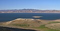 San Luis Reservoir from Romero Outlook
 -
 San Luis Dam and Gianelli Powerhouse
 -
 Satellite photo of San Luis Dam and the O'Neill Forebay


