
Shattuck, Oklahoma
Shattuck, Oklahoma | ||
|---|---|---|
FIPS code 40-66750[3] | | |
| GNIS feature ID | 2413278[2] | |
| Website | shattuckok | |
Shattuck is a town in
History
Shattuck is located in what was once the
On May 25, 2021, an earthquake magnitude 4.1 on the Richter Scale occurred a few miles west of Shattuck, despite it not being an area known for earthquakes. [7]
Geography
Shattuck is located west of the center of Ellis County. U.S. Route 283 passes through the center of town, leading north 30 miles (48 km) to Laverne and south 15 miles (24 km) to Arnett, the Ellis county seat. Oklahoma State Highway 15 passes through the southeast part of Shattuck, leading northeast 30 miles (48 km) to Woodward. The Texas border is 7 miles (11 km) west of Shattuck.
According to the United States Census Bureau, the town has a total area of 2.2 square miles (5.8 km2), all land.[5]
Demographics
| Census | Pop. | Note | %± |
|---|---|---|---|
| 1910 | 1,231 | — | |
| 1920 | 1,365 | 10.9% | |
| 1930 | 1,490 | 9.2% | |
| 1940 | 1,275 | −14.4% | |
| 1950 | 1,692 | 32.7% | |
| 1960 | 1,625 | −4.0% | |
| 1970 | 1,546 | −4.9% | |
| 1980 | 1,759 | 13.8% | |
| 1990 | 1,454 | −17.3% | |
| 2000 | 1,274 | −12.4% | |
| 2010 | 1,356 | 6.4% | |
| 2020 | 1,249 | −7.9% | |
| U.S. Decennial Census[8] | |||
As of the
In the town, the population was spread out, with 20.0% under the age of 18, 6.1% from 18 to 24, 20.4% from 25 to 44, 28.3% from 45 to 64, and 25.1% who were 65 years of age or older. The median age was 47 years. For every 100 females, there were 88.2 males. For every 100 females age 18 and over, there were 81.3 males.
The median income for a household in the town was $26,758, and the median income for a family was $35,250. Males had a median income of $32,375 versus $18,077 for females. The
Parks, recreation and attractions
City Park has playground equipment, tennis courts, covered picnic facilities, and a mile-long Lighted Walking Trail at Centennial Lake.[9] It also has Shattuck Public Swimming Pool.[10]
The municipal/semi-private Shattuck Golf and Country Club has nine holes and was built in 1950.[11]
Gage Beach, Oklahoma’s largest outdoor swimming pool, is seven miles east of Shattuck; the spring-fed waters of this 100-year-old pool are mineral-rich.[9]
Lake Lloyd Vincent and the Ellis County Wildlife Management Area are well south of town, but in Shattuck’s zip code.[12][13]
The Shattuck Windmill Museum has a large number of vintage windmills, as well as versions of some early settler buildings.[14]
The following locations are NRHP-listed:
Shattuck National Bank Building was built in 1910, with a second floor added in 1913. It became the Shattuck Public Library in 1963.[15] Wall murals inside the building depict the history of Shattuck from 1838 to the present.[9]
The Ingle Brothers Broomcorn Warehouse was built in 1909, and is a gable-front brick building with a stepped gable.[16]
References
- ^ "ArcGIS REST Services Directory". United States Census Bureau. Retrieved September 20, 2022.
- ^ a b U.S. Geological Survey Geographic Names Information System: Shattuck, Oklahoma
- ^ a b "U.S. Census website". United States Census Bureau. Retrieved January 31, 2008.
- ^ "Shattuck (town), Oklahoma". United States Census Bureau. Retrieved August 29, 2023.
- ^ a b "Geographic Identifiers: 2010 Demographic Profile Data (G001): Shattuck town, Oklahoma". American Factfinder. U.S. Census Bureau. Archived from the original on February 13, 2020. Retrieved March 10, 2016.
- ^ a b c d e f Everett, Dianna. "Shattuck," Encyclopedia of Oklahoma History and Culture, Oklahoma Historical Society, June 24, 2015.
- ^ "Magnitude 4.1 earthquake rattles Oklahoma, also felt in Texas and Kansas".
- ^ "Census of Population and Housing". Census.gov. Retrieved June 4, 2015.
- ^ a b c "Shattuck". RedCarpetCountry.com. Retrieved August 11, 2020.
- ^ "Shattuck Public Swimming Pool". Facebook. Retrieved August 11, 2020.
- ^ "Shattuck Golf & Country Club". GolfAdvisor.com. Retrieved August 11, 2020.
- ^ "Lake Lloyd Vincent". Google Maps. Retrieved August 11, 2020.
- ^ "Ellis County Wildlife Management Area". Google Maps. Retrieved August 11, 2020.
- ^ "Homepage". Shattuck Windmill Museum. Retrieved August 11, 2020.
- ^ "National Register of Historic Places Inventory-Nomination Form, Shattuck National Bank Building". National Park Service. Retrieved August 11, 2020.
- ^ "News 2009". Shattuck Windmill Museum. Retrieved August 11, 2020.
External links
- Town of Shattuck official website
- Shattuck Chamber of Commerce
- Encyclopedia of Oklahoma History & Culture
- Shattuck Windmill Museum & Park
Municipalities and communities of Ellis County, Oklahoma, United States | ||
|---|---|---|
| Towns | 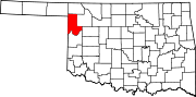 | |
| Unincorporated communities | ||
| Ghost town | ||
| ||