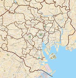
Shiomi, Tokyo
Shiomi
潮見 | |
|---|---|
District | |
 An intersection in Shiomi | |
| Coordinates: 35°39′32.2″N 139°49′02.7″E / 35.658944°N 139.817417°E | |
| Country | Japan |
| Prefecture | Tokyo |
| Area | |
| • Total | 0.69 km2 (0.27 sq mi) |
| Population (August 2015)[2] | |
| • Total | 5,931 |
| Postal Code | 135-0052 |
| [3] | |
Shiomi (潮見) is a district in
Kōtō
, Japan.
Education
Koto Ward Board of Education operates public elementary and junior high schools.
Edagawa Elementary School ( 枝川小学校) is the zoned public elementary school for Shiomi.[4]
Fukagawa No. 8 Junior High School (深川第八中学校) is the zoned junior high school for Shiomi.[5]
35°39′32″N 139°49′02″E / 35.65889°N 139.81722°E
References
- ^ "平成22年 東京都区市町村町丁別報告". Retrieved 29 Aug 2015.
- ^ "江東区の世帯と人口" (PDF). Archived from the original (PDF) on 2015-09-29. Retrieved 29 Aug 2015.
- ^ "潮見の郵便番号". Retrieved 28 Sep 2015.
- ^ "江東区立 小学校・義務教育学校前期課程 通学区域一覧" (PDF). Koto Ward. Retrieved 2022-10-09.
- ^ "江東区立 中学校・義務教育学校後期課程 通学区域一覧" (PDF). Koto Ward. Retrieved 2022-10-09.


