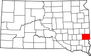
South Sioux Falls, South Dakota
South Sioux Falls was an incorporated community located in south-central
History

South Sioux Falls was founded in early 1888 on 4 acres (16,000 m2) of land donated by lawyer and congressman
The city once covered 1,800 acres (7.3 km2) and had a woolen mill, soap factory, an axle grease factory, and the first airport in the region—Soo Skyways.
A merger with Sioux Falls was proposed in the 1940s and was followed by lobbying from the South Sioux Falls city commission for a repeal of the statewide ban on municipal consolidation.[5] The state legislature repealed the ban in 1951, allowing for studies into consolidation to commence.[6] A ballot proposition to merge the cities was defeated by South Sioux Falls voters on April 15, 1952, despite a parallel proposition passing in Sioux Falls.[7] A second attempt was made in 1955, with terms agreed by the two city governments to take over the debts of South Sioux Falls and combine school districts.[8][9] On October 18, 1955, South Sioux Falls voted 704–227 in favor of consolidating.[10] The same ballot proposition was approved by Sioux Falls voters on November 15, by a 2,714–450 margin.[2][11]
The consolidation took effect on December 31, 1955. The mayors of Sioux Falls and South Sioux Falls were planned to preside over a ceremony to dismantle a "Welcome to South Sioux Falls" sign on Minnesota Avenue; the event was cancelled after the sign was set on fire.[12]
References
- ^ "US Gazetteer files: 2010, 2000, and 1990". United States Census Bureau. February 12, 2011. Retrieved April 23, 2011.
- ^ Newspapers.com.
- ^ Smorada, James (July 13, 2002). "Marker recalls Sioux Falls' streetcars of the late 1800s". Argus Leader. p. 1D. Retrieved January 1, 2022 – via Newspapers.com.
- ^ Smith, David H. (December 25, 1955). "Boom Gave Rise to So. Sioux". Sioux Falls Argus-Leader. p. 12C. Retrieved January 1, 2022 – via Newspapers.com.
- ^ "So. Sioux Falls Commission Asks End of City Merger Ban". Sioux Falls Argus-Leader. November 22, 1950. p. 4. Retrieved January 1, 2022 – via Newspapers.com.
- ^ "Commission Studies City Merger Plan". Sioux Falls Argus-Leader. June 1, 1951. p. 1. Retrieved January 1, 2022 – via Newspapers.com.
- ^ Yeager, Anson (February 9, 1955). "Dana Offers Legislation on S.S.F. and S.F. Consolidation". The Daily Argus-Leader. p. 1A. Retrieved January 1, 2022 – via Newspapers.com.
- ^ Smith, David H. (September 15, 1955). "Tentative Accord on Terms of Merger". The Daily Argus-Leader. p. 1A. Retrieved January 1, 2022 – via Newspapers.com.
- ^ Smith, David H. (November 13, 1955). "Sioux Falls to Vote on Merger Tuesday". The Daily Argus-Leader. p. 9B. Retrieved January 1, 2022 – via Newspapers.com.
- ^ Smith, David H. (October 19, 1955). "South Sioux Falls For Merger; Early S.F. Vote Assured". The Daily Argus-Leader. p. 1A. Retrieved January 1, 2022 – via Newspapers.com.
- ^ Smith, David H. (November 16, 1955). "Sioux Falls Favors Merger by 6 to 1". The Daily Argus-Leader. p. 1A. Retrieved January 1, 2022 – via Newspapers.com.
- ^ Smith, David H. (January 1, 1956). "Consolidation of Sioux Falls And South Sioux Falls Sealed". The Daily Argus-Leader. p. 1A. Retrieved January 1, 2022 – via Newspapers.com.
43°30′44″N 96°43′46″W / 43.51222°N 96.72944°W

