
Støren
Støren | |
|---|---|
Village | |
Gauldalen | |
| Municipality | Midtre Gauldal |
| Area | |
| • Total | 2.43 km2 (0.94 sq mi) |
| Elevation | 91 m (299 ft) |
| Population (2018)[1] | |
| • Total | 2,276 |
| • Density | 937/km2 (2,430/sq mi) |
| Time zone | UTC+01:00 (CET) |
| • Summer (DST) | UTC+02:00 (CEST) |
| Post Code | 7290 Støren |
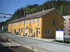
Rørosbanen railway lines is at Støren Station in the northern part of the village. Støren Church, a school, government services, and commercial and industrial sites are all located in the village.[3]
The 2.43-square-kilometre (600-acre) village has a population (2018) of 2,276 and a population density of 937 inhabitants per square kilometre (2,430/sq mi).[1]
Name
The village (and parish/municipality) was named after the old Støren farm (
Old Norse: Staurin), since the first Støren Church was built there. The first element is staurr' which means "pointed pole" and the last element is vin which means "meadow" or "pasture". The word staurr is probably referring to the pointed headland on which the church is located. The two rivers that form this headland are the Gaula and Sokna.[4]
Media gallery
-
 Village centre
 -
 Størenhallen
 -
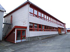 School in Støren
 -
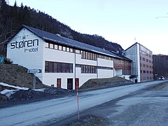 Støren hotel
 -

-
.JPG)
.JPG)
.JPG)
.JPG)


Popular culture
The Norwegian movie Bør Børson made Støren famous. In this movie, the protagonist, Bør Børson, is visiting a fictional Støren bakery.
References
- ^ a b c Statistisk sentralbyrå (1 January 2018). "Urban settlements. Population and area, by municipality".
- ^ "Støren, Midtre Gauldal (Trøndelag)". yr.no. Retrieved 2018-01-21.
- Store norske leksikon (in Norwegian). Kunnskapsforlaget. Retrieved 2018-01-15.
- ^ Rygh, Oluf (1901). Norske gaardnavne: Søndre Trondhjems amt (in Norwegian) (14 ed.). Kristiania, Norge: W. C. Fabritius & sønners bogtrikkeri. p. 239.