
St. Matthew Island (phantom island)

St Matthew Island (
Peter Mundy refers in 1656 to St Matthew Island when writing about Ascension, with some words changed to be more understandable in brackets:
[So] now [again] concerning the Ascention birds [also], [that] can neither fly nor [swim]. The [island] [being] [about] 300 leagues from the coast of [Guinea] and 160 leagues from the [island] of St Matheo, the nearest land to it, the question is, how they [should] [be] generated, [whether] created there from the beginning, or [that] the earth [produce] them of its [own] accord, as mice, [serpents], flies, [worms], etts, insects, or [whether] the nature of the earth and climate have [altered] the [shape] and nature of some other [foul] into this, I leave it to the learned to dispute of.
— Peter Mundy, The Travels of Peter Mundy
Captain James Cook tried but failed to find St. Matthew in 1775 during his second voyage.[2]
Both Peter Leonard (1833) and
Gallery
-
 Ortelius' 1570 "Africae Tabula Nova" showing "S. Matheo"
 -
 Gerard de Jode's 1593 map showing "I.de S.Matheus"
 -
 Gerardus Mercator's 1595 map from the Atlas sive Cosmographicae meditationes de fabrica mvndi et fabricati figvra showing "S. Matheo"
 -
 Jan Huygen van Linschoten's 1596 map showing "I. de S. Matheus"
 -
 James Rennel's 1799 map showing "S. Matthew"
 -
 Arrowsmith and Lewis 1812 map showing "St. Mathew"
 -
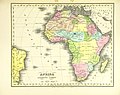
 1827 map by Anthony Finley showing "S. Matthew"
 -
 1828 German map showing "St. Mathäus"
 -
 1836 Atlas showing "I. St. Matthew"

.jpg)
.jpg)


.jpg)
See also
References
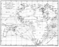
- ^ "Mar di Æthiopia Vulgo Oceanus Æthiopicus, Jansson, 1650". St. Helena Virtual Library and Archive. Archived from the original on 11 January 2007. Retrieved 13 May 2009.
- ^ Cook, James (1813). The voyages of Captain James Cook round the world: printed verbatim from the original editions, and embellished with a selection of the engravings, Volume 4. London: Sherwood, Neely, and Jones. p. 248. Retrieved 15 March 2011.
- ISBN 9780811530729. Retrieved 15 March 2011.
- ^ Adams, H. C. (1883). Travellers' tales, a book of marvels. George Routledge and Sons. pp. 139–143. Retrieved 15 March 2011.
External links
This article about a location in Ascension Island is a stub. You can help Wikipedia by expanding it. |