Suontee
| Suontee | |
|---|---|
Kymijoki | |
| Basin countries | Finland |
| Max. length | 38 km (24 mi) |
| Surface area | 149 km2 (58 sq mi) |
| Average depth | 8.8 m (29 ft) |
| Max. depth | 43.65 m (143.2 ft) |
| Water volume | 0.7 km3 (0.17 cu mi) |
| Shore length1 | 627.254 km (389.758 mi) |
| Surface elevation | 94 m (308 ft) |
| Frozen | December–April |
| Islands | Joussaari, Isosaari, Mankinsaari, Kuivassaari |
| 1 Shore length is not a well-defined measure. | |
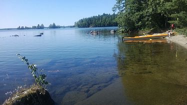
Suontee (also: Suonteejärvi) is a rather large lake in
Southern Savonia. The southern part is in a more natural state with very clear water, and it is included in the Natura 2000 conservation network of the EU. The protection area is 2 625 hectare. A typical bird there is the black-throated loon. In the past two big lakes, Suontee and Puula
, were one lake until 1854, when the water level was lowered 2.5 meters. This has brought up geological stacks, which are formed by water.
|
See also
- List of lakes in Finland
References
- Suontee in Järviwiki. Accessed 10 February 2014.
- Natura-area of Suontee. Finnish Environmental Administration. Accessed 10 February 2014. (in Finnish)
External links
 Media related to Suontee at Wikimedia Commons


