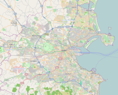
Tallaght Luas stop
 Tallaght stop, as seen from beyond the buffers | |
| General information | |
| Location | Hibernian Industrial Estate Tallaght, County Dublin Ireland |
| Coordinates | 53°17′15″N 6°22′29″W / 53.28748243338293°N 6.3746674870170255°W |
| Owned by | Transport Infrastructure Ireland |
| Operated by | Transdev (as Luas) |
| Line(s) | Red |
| Platforms | 2 |
| Bus routes | 8 |
| Bus operators | Dublin Bus, Go-Ahead Ireland |
| Connections |
|
| Construction | |
| Structure type | At-grade |
| Other information | |
| Fare zone | Red 4 |
| History | |
| Opened | 26 September 2004 |
| Location | |
Tallaght (/ˈtælə/; Irish: Tamhlacht) is a stop on the Luas light-rail tram system in Dublin, Ireland. It opened in 2004 as the terminus of the Red Line.[1]
Location and access
| ||||||||||||||||||||||||||||||||||||||||||||||||||||||||||||||||||||||||||||||||||||||||||||||||||||||||||||||||||||||||||||||||||||||||||||||||||||||||||||||||||||||||||||||||||||||||||||||||||||||||||||||||||||||||||||||||||||||||||||||||||||||||||||||||||||||||||||||||||||||||||||||||||||||||||||
The stop is located on a section of reserved track at the side of the road the populous suburb of
The Square Shopping Centre. It also provides access to Tallaght Stadium, the offices of South Dublin County Council, and the local campus of the Technological University Dublin.[2] The stop has two edge platforms, and trams reverse using a double crossover immediately beyond the stop. Thus, one platform is used for arrivals and one for departures. Upon leaving Tallaght, trams travel along their own right of way, rounding a corner where the tracks are straddled by buildings. They then head north on their way to Connolly or The Point
.

Services
Trams stop at the stop coming from either end every 2-10 minutes.
| Preceding station | Following station | |||
|---|---|---|---|---|
| Cookstown towards Tallaght
|
Red Line | Kingswood | ||
| Fettercairn towards Saggart
| ||||
References
- ^ "Luas is launched - 2004". RTÉ Archives.
- ^ "Tallaght". Luas.

