
Tantalus-Round Top Road
Tantalus-Round Top Road | |
Honolulu, Hawaii | |
| Coordinates | 21°19′51″N 157°49′1″W / 21.33083°N 157.81694°W |
|---|---|
| Area | 7 miles |
| Built | 1892 |
| NRHP reference No. | 08000373[1] |
| Added to NRHP | August 14, 2009 |
The winding, hillside road from
All-American Roads.[2]
Gallery
-
 University of Hawaii at Manoa and Diamond Headfrom Round Top Drive
 -
 View of Diamond Head from Tantalus Drive
 -
 Trees lining Puʻu ʻUalakaʻa State Wayside entrance, Round Top Drive
 -
 View toward Nuʻuanu Valley from Tantalus Drive
 -
 Mountaintop home and tropical foliage, Tantalus Drive
 -
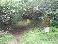 ʻUalakaʻa Trail crossing, Round Top Drive


References
Wikimedia Commons has media related to Tantalus-Round Top Road.
- ^ "National Register Information System". National Register of Historic Places. National Park Service. July 9, 2010.
- ^ Mary Vorsino (2007-06-20). "History taking note of Tantalus roadway". Honolulu Advertiser. Retrieved 2009-11-05.
| Topics | |
|---|---|
| Lists by state |
|
| Lists by insular areas | |
| Lists by associated state | |
| Other areas | |
| Related | |