Tekasi

Tekasi is an islet in
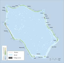
Penrhyn Atoll (Tongareva) in the Cook Islands, in the South Pacific Ocean.[1] It is located on the north-west edge of the atoll, next to the northwest passage into the lagoon and north of Matunga. The island was once a camping place for fishermen.[2]
The islet is uninhabited.
References
- ^ Liu Chuang; Shi Ruixiang; Chen Lijun (January 2019). "Penrhyn Atoll". Institute of Geographical Sciences and Natural Resources Research, Chinese Academy of Sciences. Retrieved 10 August 2020.
- ^ Te Rangi Hiroa (1964). Vikings of the Sunrise. Christchurch: Whitcombe and Tombs Limited. p. 137. Retrieved 21 August 2020.
8°55′29.09″S 158°3′4.4″W / 8.9247472°S 158.051222°W
