
Toyahvale, Texas
Toyahvale | ||
|---|---|---|
ZIP codes 79786 | ||
| GNIS feature ID | 1370067 | |

Toyahvale is an
ZIP code of 79786.[3]
Toyahvale reported a population of 25 in 1925 and 150 in 1926. In 1933, the population was back down to 25. Between 1950 and 1990, the population was reported as between 50-60 people and the latest numbers recorded a population of 60 in 2000.[4]
Toyahvale's name is a
vale". The community was established after 1884, but its first post office was not opened until 1894. It closed in 1931, but reopened in 1933. Toyahvale used to be the western terminus of the Pecos Valley Southern Railway until the line was trimmed back to Saragosa in 1971. It is also the location of Balmorhea State Park.[5]
Climate
According to the
Köppen Climate Classification system, Toyahvale has a semi-arid climate, abbreviated "BSk" on climate maps.[6]
References
- ^ Rand McNally. The Road Atlas '08. Chicago: Rand McNally, 2008, p. 99.
- ^ U.S. Geological Survey Geographic Names Information System: Toyahvale, Texas
- ^ Zip Code Lookup
- ^ SMITH, JULIA CAUBLE (June 15, 2010). "TOYAHVALE, TX". tshaonline.org. Retrieved December 5, 2019.
- ^ Toyahvale, Texas, Handbook of Texas Online, 2008-01-18. Accessed 2008-08-11.
- ^ Climate Summary for Toyahvale, Texas
External links
Municipalities and communities of Reeves County, Texas, United States | ||
|---|---|---|
| Cities | 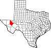 | |
| Town | ||
| CDP | ||
| Other communities | ||
| Ghost town | ||
| ||