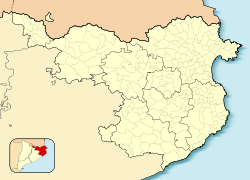
Vall-llobrega
Vall-llobrega | |
|---|---|
 St. Matthew's church (11th century) | |
| Coordinates: 41°53′N 3°8′E / 41.883°N 3.133°E | |
| Country | |
| Community | |
| Province | |
| Comarca | Baix Empordà |
| Government | |
| • Mayor | Rufino Guirado Iruela (2015)[1] |
| Area | |
| • Total | 5.4 km2 (2.1 sq mi) |
| Population (2018)[3] | |
| • Total | 912 |
| • Density | 170/km2 (440/sq mi) |
| Website | www |
Vall-llobrega (Catalan pronunciation: autonomous community of Catalonia, Spain.
The first evidence of human settlement in the Vall-llobrega area is the Dolmen de Montagut, on the top of Montagut hill between Vall-llobrega and Palamós. Dating from the 3rd or 2nd millennium BC, this has 3 slabs in their original state and the remains of a tomb that these once covered.[4][5]
References
- Generalitat of Catalonia. Retrieved 2015-11-13.
- Statistical Institute of Catalonia. Retrieved 2015-11-23.
- ^ Municipal Register of Spain 2018. National Statistics Institute.
- ^ "Vestigis prehistòrics" [Prehistoric remains] (in Catalan). Ajuntament de Vall-llobrega. Retrieved 21 November 2022.
- ISBN 978-84-92811-89-2.
External links
- Government data pages (in Catalan)


